


Die Tour nutzt die Robiei – Bergbahn um von S. Carlo am Ende des Valle Bavona in eine Kunstwelt zu gelangen (Berg- und Talfahrt zusammen 2012: 20 CHF p.P.).
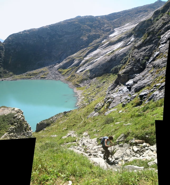
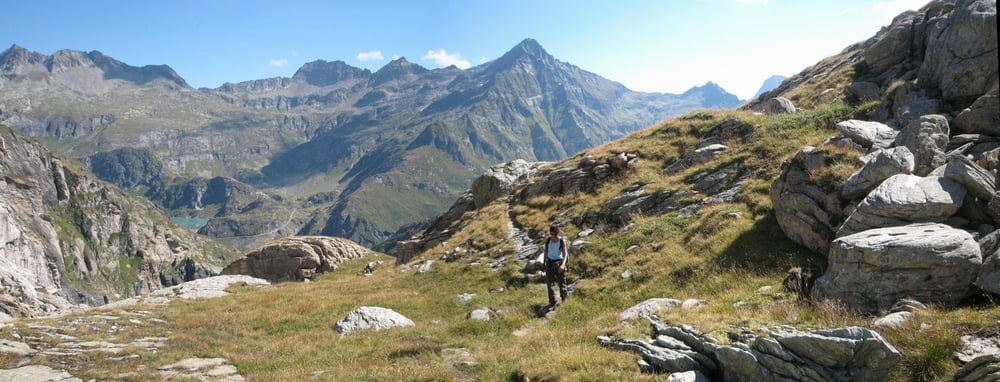
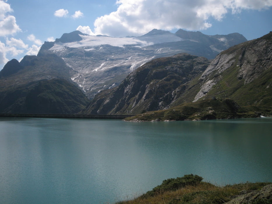
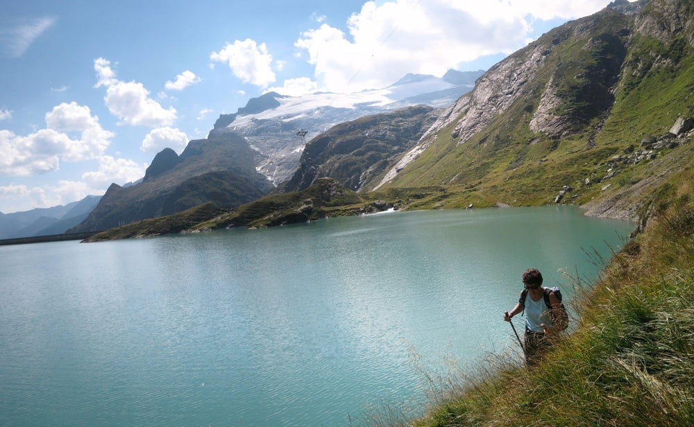
Die Seen dort oben sind zwar allesamt Talsperren. Trotzdem ist die Landschaft recht schön zumal man in Sichtweite des Basodino – Gletschers wandert. Die Runde lässt noch genügend Zeit um es sich auf der Terrasse der Basodino-Hütte oder des Hotels Robiei gut gehen zu lassen denn in den Stauseen ist Baden ja eh extrem gefährlich und deshalb verboten obwohl es hier eigentlich schön einsam ist!
Die Seen dort oben sind zwar allesamt Talsperren. Trotzdem ist die Landschaft recht schön zumal man in Sichtweite des Basodino – Gletschers wandert. Die Runde lässt noch genügend Zeit um es sich auf der Terrasse der Basodino-Hütte oder des Hotels Robiei gut gehen zu lassen denn in den Stauseen ist Baden ja eh extrem gefährlich und deshalb verboten obwohl es hier eigentlich schön einsam ist!
Further information at
http://www.ticino.ch/de/Tour gallery
Tour map and elevation profile
Minimum height 1802 m
Maximum height 2243 m
More about the tour author
|
|
Saxoniaradler |
Comments

Aus Deutschland kommend fährt man am besten durch den San Bernardino-Tunnel und bezahlt dann Autobahnmaut in Austria und in der Schweiz, aber das Benzin ist halt viel billiger ….!! Dann geht es noch sehr weit in Maggiatal hinein. Aber für Camper am Waldbad in Freiberg ist es eh ein bisschen weit!? ;-)
GPS tracks
Trackpoints-
GPX / Garmin Map Source (gpx) download
-
TCX / Garmin Training Center® (tcx) download
-
CRS / Garmin Training Center® (crs) download
-
Google Earth (kml) download
-
G7ToWin (g7t) download
-
TTQV (trk) download
-
Overlay (ovl) download
-
Fugawi (txt) download
-
Kompass (DAV) Track (tk) download
-
Track data sheet (pdf) download
-
Original file of the author (gpx) download
More about the tour author
|
|
Saxoniaradler |
Add to my favorites
Remove from my favorites
Edit tags
Open track
My score
Rate