


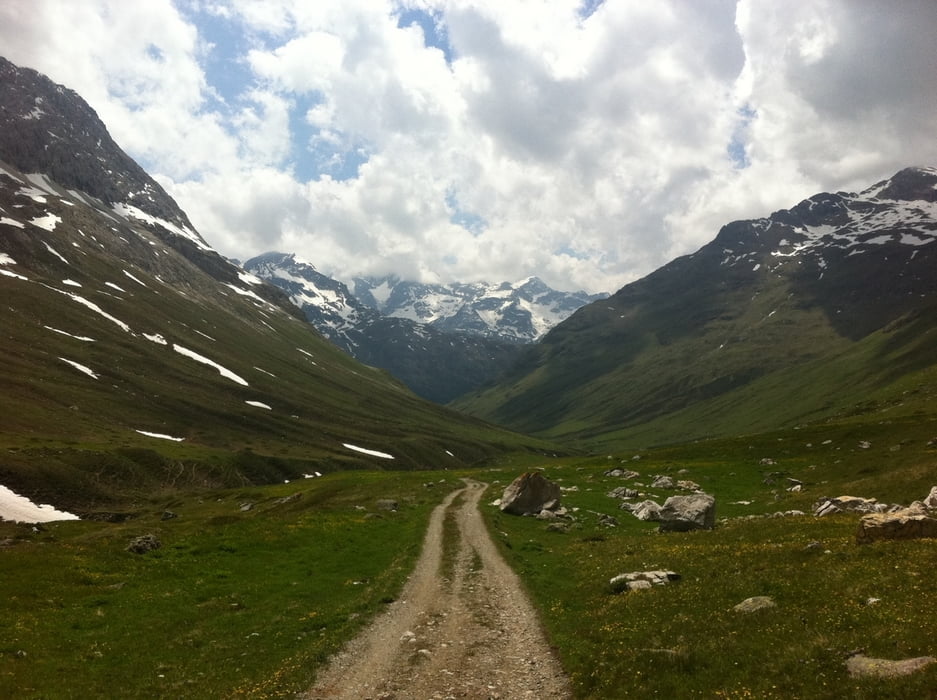
Eine sehr schöne Tour im Gebiet um St. Moritz. Vom Startpunkt Pontresina über einen Wanderweg bis nach Morteratsch mit einem eindrucksvollen Blick auf den gleichnamigen Gletscher. Weiter Richtung Berninapass bis nach Bernina Suot, wo man in das Val da Fain abbiegt. Auf einem moderat ansteigenden Weg bis zur Alp Stretta und weiter bis zur Passhöhe La Stretta - Grenzübergang nach Italien.
Auf demselben Weg retour.
Tour gallery

Tour map and elevation profile
Minimum height 1805 m
Maximum height 2476 m
More about the tour author

|
rushy |
Comments

Von St. Moritz über die Engadinstrasse und die Via da Bernina nach Pontresina
GPS tracks
Trackpoints-
GPX / Garmin Map Source (gpx) download
-
TCX / Garmin Training Center® (tcx) download
-
CRS / Garmin Training Center® (crs) download
-
Google Earth (kml) download
-
G7ToWin (g7t) download
-
TTQV (trk) download
-
Overlay (ovl) download
-
Fugawi (txt) download
-
Kompass (DAV) Track (tk) download
-
Track data sheet (pdf) download
-
Original file of the author (gpx) download
More about the tour author
|
|
rushy |
Add to my favorites
Remove from my favorites
Edit tags
Open track
My score
Rate