


kleine Runde_ganz Groß oder nur 17 Km aber dafür 400 Hm und bis auf 600 Meter Höhe!
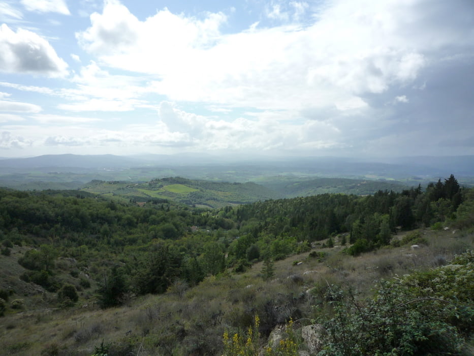
Schöne Tour im Chianti zum Teil auf der "Strada bianca" mit schönen Anstiegen. Am höchsten Punkt wird man mit einem traumhaften Blick in den Chianti belohnt!
Start/Ziel: San Donato in Poggio an der Bar/Tabacchi ( hier gibt es dann die Belohnungen für die Anstrengungen, Cappu und Süßteil! )
Viel Spaß!
Empfehlung: Unbedingt die Zeit für eine Besichtigung von San Donato einplanen!
San Donato in Poggio
Im Ort San Donato in Poggio stammen die Häuser zum Teil noch aus dem 14. Jahrhundert. Stadttore, enge Gassen und Durchgänge verleihen dem Dorf San Donato in Poggio abseits der gängigen Reiserouten ein wahrhaft historisches Flair.
Further information at
http://www.toskanalive.de/toskana-regionen/florenz-der-norden/chianti/san-donato-in-poggio.htmlTour gallery
Tour map and elevation profile
Minimum height 314 m
Maximum height 593 m
More about the tour author
|
|
FLU |
Comments

GPS tracks
Trackpoints-
GPX / Garmin Map Source (gpx) download
-
TCX / Garmin Training Center® (tcx) download
-
CRS / Garmin Training Center® (crs) download
-
Google Earth (kml) download
-
G7ToWin (g7t) download
-
TTQV (trk) download
-
Overlay (ovl) download
-
Fugawi (txt) download
-
Kompass (DAV) Track (tk) download
-
Track data sheet (pdf) download
-
Original file of the author (gpx) download
More about the tour author
|
|
FLU |
Add to my favorites
Remove from my favorites
Edit tags
Open track
My score
Rate