Login

Forgot your login?

Cookies have to be accepted!
Your browser's cookie functionality is disabled. Please enable this functionality.

Not a member yet?

Register now
Login

Available for registred users only

Log in to use this feature.

Forgot your login?

Cookies have to be accepted!
Your browser's cookie functionality is disabled. Please enable this functionality.

Not a member yet?

Register now
Filter
Categories
Advanced filters
  • Distance (km)
  • Height
Save filters Reset filter

TrackRank

QRCode

Technical data

Distance26,3 km Height666 m Way down671 m Duration04:00 h:m Date12.10.2012
Scores Author Landscape Fun factor Fitness Technique

Statistics

1238 Views Scores 63 Downloads Average
Rate
  • Track data sheet
  • Directions
  • Downloads

Mit dem Taxi fahren wir zu Aussichtspunkten ,wobei der Taxifahrer zum

Reiseleiter wird,und uns viele Erklärungen gibt.

An einer Gaststätte setzt uns der Taxifahrer ab.

Wir trinken noch etwas und gehen dann los.

Die Wanderung ist ca. 13 km lang.

Die Wanderung geht hinunter nach Milna und dann an der Küste vorbei nach Hvar.

In Milna kann man gut essen und trinken.

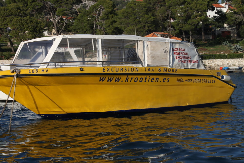
Further information at

http://www.kroatien.es

Tour gallery

Tour map and elevation profile

  • Open Street Map
  • Google
Minimum height -2 m Maximum height 388 m Detailed view

More about the tour author

Brunodick
Member since 2008

Send private message

Comments

GPS tracks

Trackpoints
  • GPX / Garmin Map Source (gpx) download
  • TCX / Garmin Training Center® (tcx) download
  • CRS / Garmin Training Center® (crs) download
  • Google Earth (kml) download
  • G7ToWin (g7t) download
  • TTQV (trk) download
  • Overlay (ovl) download
  • Fugawi (txt) download
  • Kompass (DAV) Track (tk) download
  • Track data sheet (pdf) download
  • Original file of the author (gpx) download

More about the tour author

Brunodick
Member since 2008

Send private message
Share track
Add to my favorites
Remove from my favorites
Edit tags
My score
Rate
Track: Verlassenes Dorf -Milna-Hvar
Type: Hiking
Distance: 26,3 km
Evaluated on:
Duration:
Day(s)
Hour(s)
Minute(s)
Score: Landscape Fun factor Fitness Technique