


Über Feld-und Waldwege:
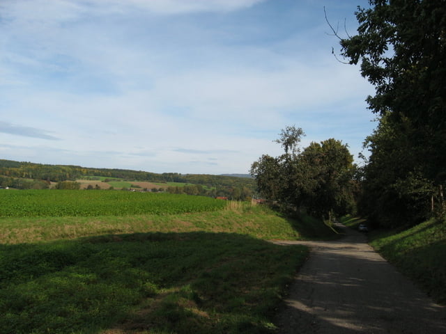
Erst durchs flache Angelbachtal. Die sist ein netter Spazierweg den man auch mit Fnmilie lang fahren kann. dort gibt es den Tierpark in rauenberg und das Wasserschloss Eichtersheim. Von Waldangelloch über die Hügel und durch den Wald nach Sinsheim (dem Wanderweg mit den roten Quadraten folgend), von dort über einsame schöne Feldwegen nach Eschelbronn und zurück nach Baiertail und Wiesloch. Der letzte Abschnitt von Baiertal in den Steinbruch ist allersings etwas hin und zurück geworden. das könnte man wohl besser etwas abkürzen.
Erst durchs flache Angelbachtal. Die sist ein netter Spazierweg den man auch mit Fnmilie lang fahren kann. dort gibt es den Tierpark in rauenberg und das Wasserschloss Eichtersheim. Von Waldangelloch über die Hügel und durch den Wald nach Sinsheim (dem Wanderweg mit den roten Quadraten folgend), von dort über einsame schöne Feldwegen nach Eschelbronn und zurück nach Baiertail und Wiesloch. Der letzte Abschnitt von Baiertal in den Steinbruch ist allersings etwas hin und zurück geworden. das könnte man wohl besser etwas abkürzen.
Tour gallery
Tour map and elevation profile
Minimum height 110 m
Maximum height 277 m
More about the tour author

|
Foxy |
Comments

GPS tracks
Trackpoints-
GPX / Garmin Map Source (gpx) download
-
TCX / Garmin Training Center® (tcx) download
-
CRS / Garmin Training Center® (crs) download
-
Google Earth (kml) download
-
G7ToWin (g7t) download
-
TTQV (trk) download
-
Overlay (ovl) download
-
Fugawi (txt) download
-
Kompass (DAV) Track (tk) download
-
Track data sheet (pdf) download
-
Original file of the author (gpx) download
More about the tour author
|
|
Foxy |
Add to my favorites
Remove from my favorites
Edit tags
Open track
My score
Rate