


Diese Etappe des Arnoweges führt von dem schönen Ort Mattsee über Berndorf zum Kloster von Michaelbeuern.
Sie ist eine Fortsetzung der Etappe 8-59 (Von Irrsdorf nach Mattsee)
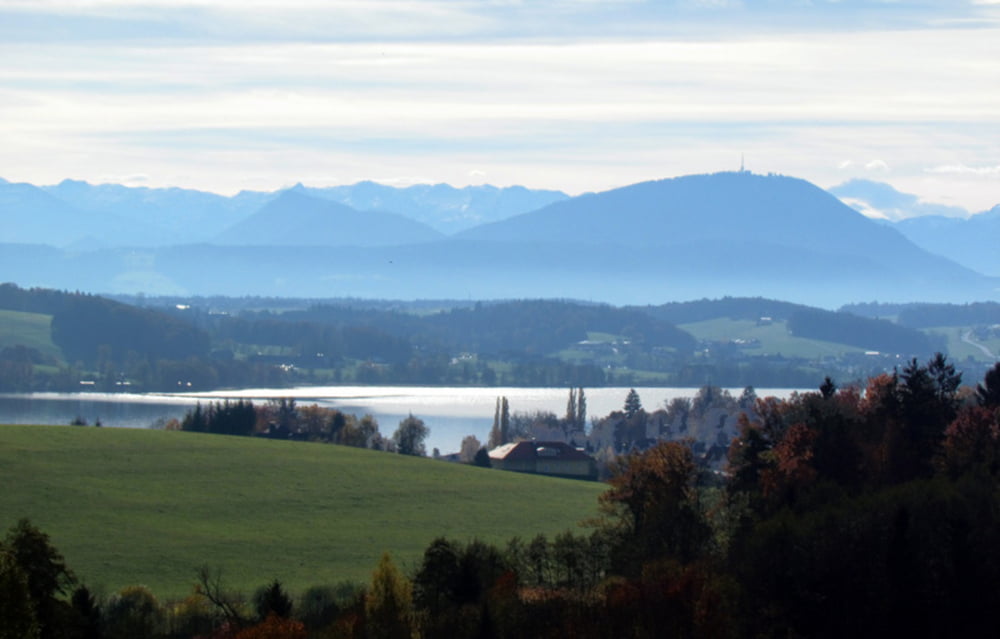
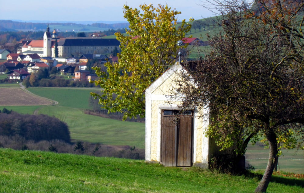
Es ist eine sehr einafche aber schöne Wanderung im Alpenvorland, Mit dabei sind auch drei Seen (Mattsee, Obertrumer See und Grabensee) und das schöne Naturschutzgebiet Oichtenriede bei Michaelbeuern. Unterwegs immer wieder sehr schöne Ausblicke auf die Alpen und auf die Trumer Seen. Herrlich auch der Blick auf das Kloster von Michaelbeuern.
Wir beginnen die Wanderung bei der Kirche in Mattsee , wandern nordwärts zum Ortsende und gehen auf dem Fußweg in Richtung Mattighofen. Nach ca. 1km biegen wir dann links ab , kommen am Pfadfinderzentrum vorbei und gelangen so nach Fraham. Dort ....... (einfach unserem gpx track folgen , der übrigens mit der Garmin fenix Outdooruhr aufgezeichnet wurde)
Unsere Empfehlung--> Arnoweg Buch von Clemens Hutter
Further information at
http://www.satcom.at/arnoweg/Tour gallery


Tour map and elevation profile
Minimum height 423 m
Maximum height 586 m
More about the tour author
|
|
GarminSalzburg |
Comments

In Mattsee stehen ausreichend Parkmöglichkeiten zur Verfügung!
GPS tracks
Trackpoints-
GPX / Garmin Map Source (gpx) download
-
TCX / Garmin Training Center® (tcx) download
-
CRS / Garmin Training Center® (crs) download
-
Google Earth (kml) download
-
G7ToWin (g7t) download
-
TTQV (trk) download
-
Overlay (ovl) download
-
Fugawi (txt) download
-
Kompass (DAV) Track (tk) download
-
Track data sheet (pdf) download
-
Original file of the author (gpx) download
More about the tour author
|
|
GarminSalzburg |
Add to my favorites
Remove from my favorites
Edit tags
Open track
My score
Rate