


Diese Tour war als Geheimtipp in der Freeride 01/07. Erst die Gardesana (leider mit Tunnel) Richtung Brescia, dann rechts abbiegen auf sehr schöne Strasse Richtung Tremosine(glaube ich). Ich bin schon vor Oldesio auf Sentiero 265 abgebogen, der Trail führt nur ein paar Hm bergab und dann Steil bergan. Sinnvoller ist es wohl Strasse bis Ortseingang Oldessio zu folgen und dann am WP in den Sentiero260 abzubiegen.
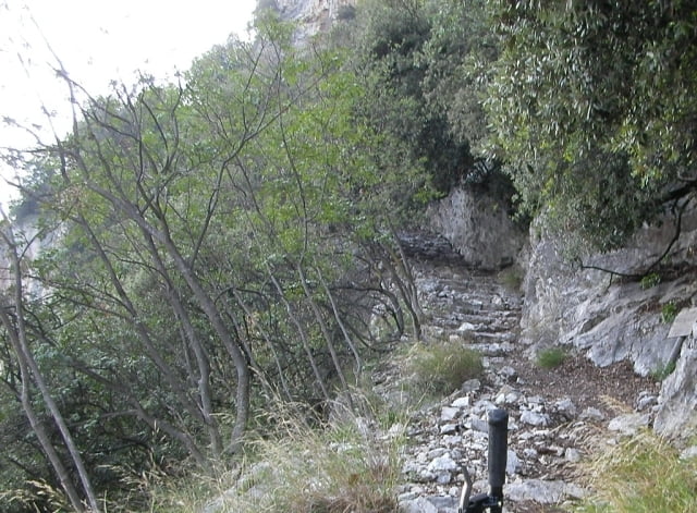
Am Anfang noch ein breiter Weg wird er dann zu einer sehr steilen und stufigen Trialabfahrt. Der Weg zieht sich in sehr engen ausgesetzten Serpentinen an einer Felswand entlang bis man in Prata della Fame durch einen Torbogen wieder am Seeufer ankommt. Schoner sind pflicht. Aussicht überwältigend.
Die Freeride hat hier 2 Flowpunkte verteilt, die habe ich übersehen. Dafür habe ich mehr als 4 Punkte für Schwierigkeit entdeckt. Und das zu einem grossen Teil zu Fuß.
Tour gallery
Tour map and elevation profile
Minimum height 68 m
Maximum height 396 m
More about the tour author

|
Comments

Ca. 10km von Limone Richtung Brescia. Direkt am Start der Tour in Prato della Fame gibts eine Parkmöglichkeit
GPS tracks
Trackpoints-
GPX / Garmin Map Source (gpx) download
-
TCX / Garmin Training Center® (tcx) download
-
CRS / Garmin Training Center® (crs) download
-
Google Earth (kml) download
-
G7ToWin (g7t) download
-
TTQV (trk) download
-
Overlay (ovl) download
-
Fugawi (txt) download
-
Kompass (DAV) Track (tk) download
-
Track data sheet (pdf) download
-
Original file of the author (gpx) download
More about the tour author
|
|
Add to my favorites
Remove from my favorites
Edit tags
Open track
My score
Rate