


This hike will test your fitness and should only be undertaken by suitably equipped hikers.
I did the hike in March 2004, and conditions were perfect, in winter the water level can be too high, and in Summer it may be too hot
The hike up through the Avakas Gorge on the Akamas peninsular in Cyprus is a stunning and rewarding journey, once committed, the only way back, is a return through the Gorge or completing the GPS track. There is no short cut.
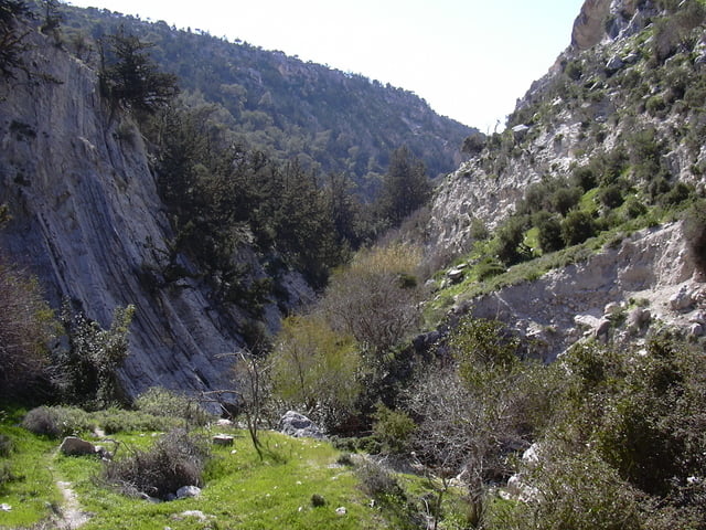
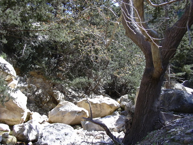
The hike follows a stream bed up through the Gorge with the limestone canyon sides as narrow as 3 to 4 metres in places, scrambling and climbing over rocks, scree slopes and boulders for about 4 km.
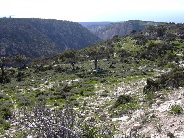
After the climb out of the Gorge, there is a good 10 km hike back, following the rim of the canyon on the dirt road from Kato Arodes to Lara. There are many fantastic viewpoints to the sea and back to the wild and beautiful Cyprus countryside.
When you arrive at the dirt coast road near Lara Bay, turn left and there is a 1.5 km walk back to the start point.
I did the hike in March 2004, and conditions were perfect, in winter the water level can be too high, and in Summer it may be too hot
The hike up through the Avakas Gorge on the Akamas peninsular in Cyprus is a stunning and rewarding journey, once committed, the only way back, is a return through the Gorge or completing the GPS track. There is no short cut.
The hike follows a stream bed up through the Gorge with the limestone canyon sides as narrow as 3 to 4 metres in places, scrambling and climbing over rocks, scree slopes and boulders for about 4 km.
After the climb out of the Gorge, there is a good 10 km hike back, following the rim of the canyon on the dirt road from Kato Arodes to Lara. There are many fantastic viewpoints to the sea and back to the wild and beautiful Cyprus countryside.
When you arrive at the dirt coast road near Lara Bay, turn left and there is a 1.5 km walk back to the start point.
Tour gallery

Tour map and elevation profile
Minimum height -7 m
Maximum height 314 m
More about the tour author

|
SILVAED |
Comments

The trail start is at the small car park at the entrance to the Avakas Gorge near the Viklari Taverna.
Reached from Paphos toward Pegeia and on to Agios Giorgios. Before reaching Agious Giorgios there is a turn off to the “Akamas peninsula”. The tarmac runs out to a rough track for another kilometre until you reach the car park.
Reached from Paphos toward Pegeia and on to Agios Giorgios. Before reaching Agious Giorgios there is a turn off to the “Akamas peninsula”. The tarmac runs out to a rough track for another kilometre until you reach the car park.
GPS tracks
Trackpoints-
GPX / Garmin Map Source (gpx) download
-
TCX / Garmin Training Center® (tcx) download
-
CRS / Garmin Training Center® (crs) download
-
Google Earth (kml) download
-
G7ToWin (g7t) download
-
TTQV (trk) download
-
Overlay (ovl) download
-
Fugawi (txt) download
-
Kompass (DAV) Track (tk) download
-
Track data sheet (pdf) download
-
Original file of the author (g7t) download
More about the tour author
|
|
SILVAED |
Add to my favorites
Remove from my favorites
Edit tags
Open track
My score
Rate