Login

Forgotten password?

Cookies have to be accepted!
Your browser's cookie functionality is disabled. Please enable this functionality.

Not a member yet?

Register now
Login

Available for registred users only

Log in to use this feature.

Forgotten password?

Cookies have to be accepted!
Your browser's cookie functionality is disabled. Please enable this functionality.

Not a member yet?

Register now
Filter
Categories
Advanced filters
  • Distance (km)
  • Height
Save filters Reset filter

TrackRank

QRCode

Technical data

Distance14,4 km Height781 m Way down624 m Duration05:05 h:m Date26.11.2012
Scores Author Landscape Fun factor Fitness Technique

Statistics

270 Views Scores 7 Downloads Average
Rate
  • Track data sheet
  • Directions
  • Downloads

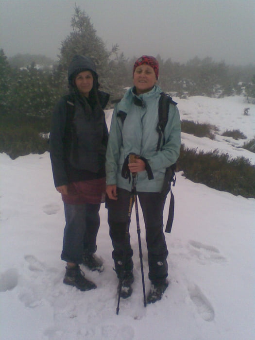
S Hanou a Markétou jsme v pátek 23.11.2012 zdrhli z školení i přes špatné počasí to bylo fajn. Udělali jsme dvě kolečka v kleči (foto) těsně pod vrcholem - první doprava druhé doleva :-) - bylo vidět na 100m - najednou jsme byli v místě ze kterého jsme do kleče vstoupili - (podle stop ve sněhu) a pak ještě jednou - bylo to dost nepříjemné - tak jsem změnil směr podél kleče nad kotel a povedlo se...
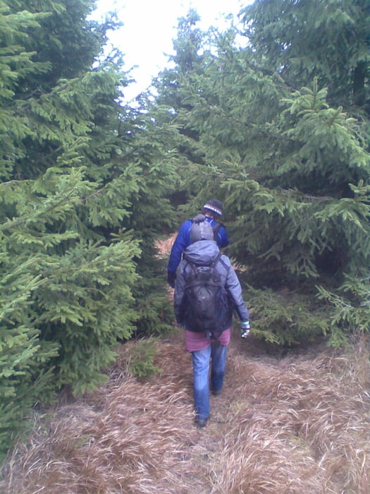
 

Tour gallery

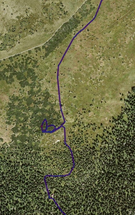
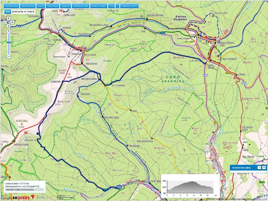
Tour map and elevation profile

  • Open Street Map
  • Google
Minimum height 717 m Maximum height 1470 m Detailed view

More about the tour author

mtbBen
Member since 2011

Send private message

Comments

GPS tracks

Trackpoints
  • GPX / Garmin Map Source (gpx) download
  • TCX / Garmin Training Center® (tcx) download
  • CRS / Garmin Training Center® (crs) download
  • Google Earth (kml) download
  • G7ToWin (g7t) download
  • TTQV (trk) download
  • Overlay (ovl) download
  • Fugawi (txt) download
  • Kompass (DAV) Track (tk) download
  • Track data sheet (pdf) download
  • Original file of the author (gpx) download

More about the tour author

mtbBen
Member since 2011

Send private message
Share track
Add to my favorites
Remove from my favorites
Edit tags
My score
Rate
Track: Karlov-Kotelská ch.-Velký Máj-Vysoká Hole-ch.Eustaška-Hvězda
Type: Mountain hiking
Distance: 14,4 km
Evaluated on:
Duration:
Day(s)
Hour(s)
Minute(s)
Score: Landscape Fun factor Fitness Technique