Login

Forgot your login?

Cookies have to be accepted!
Your browser's cookie functionality is disabled. Please enable this functionality.

Not a member yet?

Register now
Login

Available for registred users only

Log in to use this feature.

Forgot your login?

Cookies have to be accepted!
Your browser's cookie functionality is disabled. Please enable this functionality.

Not a member yet?

Register now
Filter
Categories
Advanced filters
  • Distance (km)
  • Height
Save filters Reset filter

TrackRank

QRCode

Technical data

Distance45,6 km Height813 m Way down808 m Duration02:22 h:m Date29.12.2012
Scores Author Landscape Fun factor Fitness Technique

Statistics

443 Views Scores 3 Downloads Average
Rate
  • Track data sheet
  • Directions
  • Downloads

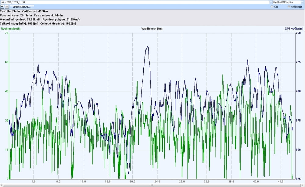
sluncem zalitá ledová hora JZ 6-10ms Twisty 6 max 55kmh

na place 50 kitů a místa pořád hafo - jezdil jsem sám backcountry - jesenické safari - mezi koňmi a zatoulaným i telaty - paráááda - až bude prašan tak se asi udělám :-)


Tour gallery

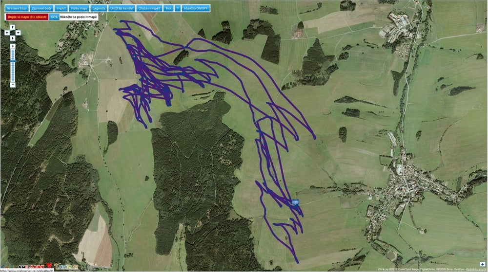
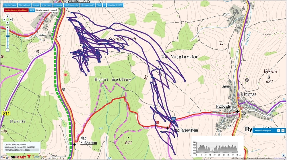
Tour map and elevation profile

  • Open Street Map
  • Google
Minimum height 630 m Maximum height 739 m Detailed view

More about the tour author

mtbBen
Member since 2011

Send private message

Comments

GPS tracks

Trackpoints
  • GPX / Garmin Map Source (gpx) download
  • TCX / Garmin Training Center® (tcx) download
  • CRS / Garmin Training Center® (crs) download
  • Google Earth (kml) download
  • G7ToWin (g7t) download
  • TTQV (trk) download
  • Overlay (ovl) download
  • Fugawi (txt) download
  • Kompass (DAV) Track (tk) download
  • Track data sheet (pdf) download
  • Original file of the author (gpx) download

More about the tour author

mtbBen
Member since 2011

Send private message
Share track
Add to my favorites
Remove from my favorites
Edit tags
My score
Rate
Track: kite Rýže 29 12 2012
Type: Paragliding and hang gliding
Distance: 45,6 km
Evaluated on:
Duration:
Day(s)
Hour(s)
Minute(s)
Score: Landscape Fun factor Fitness Technique