


Percorso facile e piacevole lungo circa 31 km di cui;
7 km di asfalto
11 km di sterrata in pianura sul parco fluviale
13 km di sterrate e sentieri sulle colline
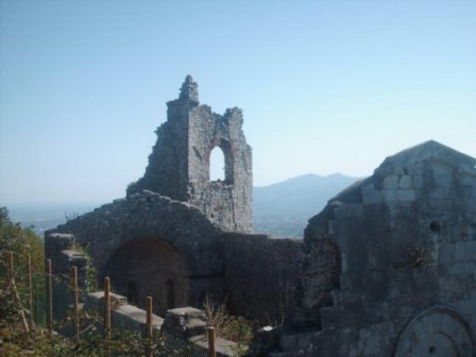
La zona del Castellaccio (posto nelle vicinanze di Aquilea)è un colle situato in posizione dominante
e panoramica a picco sulla valle del Serchio.
vedi alcune notizie:
http://www.luccaterre.it/scheda.php?id=7649&lang=it
Altra bella zona panoramica che si raggiunge è Santo Stefano di Moriano ,
denominata anche Castello (dai resti inglobati in una successiva villa)
sulla sommita del colle e che domina la piana di Moriano
http://www.diocesilucca.it/parrocchie.php?p=diocesi&s=parrocchie&id=285
Tour gallery
Tour map and elevation profile
Minimum height 22 m
Maximum height 407 m
More about the tour author
|
|
gaddo |
Comments

GPS tracks
Trackpoints-
GPX / Garmin Map Source (gpx) download
-
TCX / Garmin Training Center® (tcx) download
-
CRS / Garmin Training Center® (crs) download
-
Google Earth (kml) download
-
G7ToWin (g7t) download
-
TTQV (trk) download
-
Overlay (ovl) download
-
Fugawi (txt) download
-
Kompass (DAV) Track (tk) download
-
Track data sheet (pdf) download
-
Original file of the author (gpx) download
More about the tour author
|
|
gaddo |
Add to my favorites
Remove from my favorites
Edit tags
Open track
My score
Rate