Login

Forgot your login?

Cookies have to be accepted!
Your browser's cookie functionality is disabled. Please enable this functionality.

Not a member yet?

Register now
Login

Available for registred users only

Log in to use this feature.

Forgot your login?

Cookies have to be accepted!
Your browser's cookie functionality is disabled. Please enable this functionality.

Not a member yet?

Register now
Filter
Categories
Advanced filters
  • Distance (km)
  • Height
Save filters Reset filter

TrackRank

QRCode

Technical data

Distance43,3 km Height641 m Way down646 m Duration02:00 h:m Date30.09.2007
Scores Author Landscape Fun factor Fitness Technique

Statistics

387 Views 1 Score 74 Downloads 4.00 Average
Rate
  • Track data sheet
  • Directions
  • Downloads
Wiesloch (Palatin) - Rauenberg - Tairnbach - Eschelbach - Daisbach - Neidenstein - Eschelbronn - Zuzenhausen - Horrenberg - Dielheim - Wiesloch

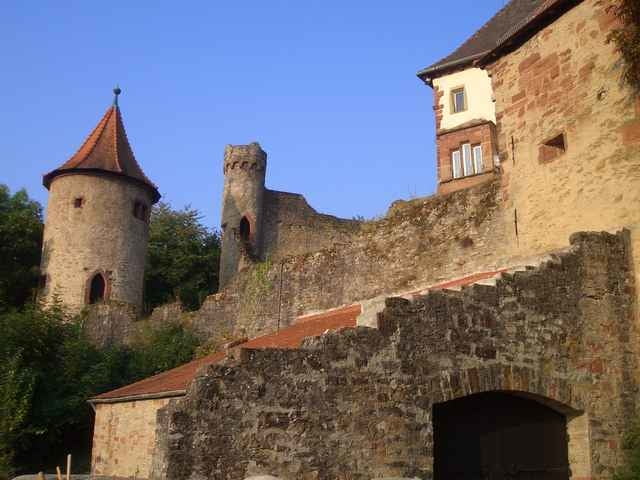
Über kleine Nebenstraßen und befestigte Feldwege durch die sanften Hügel des Kraichgaus. Höhepunkt ist die Burg Neidenstein, ein Kleinod im nördlichen Kraichgau.

Tour gallery

Tour map and elevation profile

  • Open Street Map
  • Google
Minimum height 125 m Maximum height 256 m Detailed view

More about the tour author

klemid
Member since 2005

Send private message

Comments

Foxy on 28.06.2009

Schöne Tour

Die Eigenbewertung des Autors finde ich zu bescheiden. Wenn man in dieser Gegend eine hügelige, durchaus anstrengende Tour auf festen Wegen sucht ist dies eine sehr gut Wahl. Bin sie schon 2 mal gefahren. Nur kurz vor Neidenstein ist mir zuviel Kreisstraße dabei. Da werde ich mal nach Wegen durchs Feld suchen.


Die Tour kann z.B. von Wiesloch gestartet werden.

GPS tracks

Trackpoints
  • GPX / Garmin Map Source (gpx) download
  • TCX / Garmin Training Center® (tcx) download
  • CRS / Garmin Training Center® (crs) download
  • Google Earth (kml) download
  • G7ToWin (g7t) download
  • TTQV (trk) download
  • Overlay (ovl) download
  • Fugawi (txt) download
  • Kompass (DAV) Track (tk) download
  • Track data sheet (pdf) download
  • Original file of the author (gpx) download

More about the tour author

klemid
Member since 2005

Send private message
Share track
Add to my favorites
Remove from my favorites
Edit tags
My score
Rate
Track: Neidenstein
Type: Trekkingbike
Distance: 43,3 km
Evaluated on:
Duration:
Day(s)
Hour(s)
Minute(s)
Score: Landscape Fun factor Fitness Technique