Login

Forgotten password?

Cookies have to be accepted!
Your browser's cookie functionality is disabled. Please enable this functionality.

Not a member yet?

Register now
Login

Available for registred users only

Log in to use this feature.

Forgotten password?

Cookies have to be accepted!
Your browser's cookie functionality is disabled. Please enable this functionality.

Not a member yet?

Register now
Filter
Categories
Advanced filters
  • Distance (km)
  • Height
Save filters Reset filter

TrackRank

QRCode

Technical data

Distance13,6 km Height862 m Way down857 m Duration05:00 h:m Date16.02.2013
Scores Author Landscape Fun factor Fitness Technique

Statistics

879 Views Scores 146 Downloads Average
Rate
  • Track data sheet
  • Directions
  • Downloads

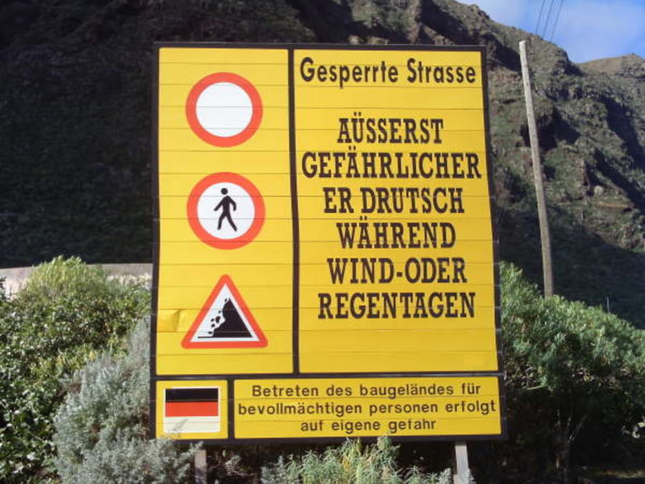
Kurz nach Buenavista, vor dem Warnschild zum Weiterfahren, startet unser Weg. Er beginnt gleich steil in die Bergflanke und ist etwas ausgesetzt. Eine schöne Aussicht bis zum Meer begleitet uns. Oben angekommen geht die Landschaft in eine sanfte Steigung mit vielen Wiesen. Unsere Sicht wurde aber jetzt stark begrenzt durch dichten Nebel. Der Weg ist eindeutig und führt direkt nach Teno Alto. Bei schönem Wetter kann man hier bestimmt nett pausieren. Wir aber gehen im ungemütlichen Wetter weiter nach El Palmar und nach einer Biegung ist die Sicht wieder weit und der Himmel nur noch bewölkt. Abwärts nach Buenavista ist der Weg kein Problem mehr.


Tour gallery

Tour map and elevation profile

  • Open Street Map
  • Google
Minimum height 113 m Maximum height 851 m Detailed view

More about the tour author

tazzo
Member since 2009

Send private message

Comments

Ein paar Hundert Meter nach Buenavista in Richtung Punta de Teno noch vor dem "Warnschild".


GPS tracks

Trackpoints
  • GPX / Garmin Map Source (gpx) download
  • TCX / Garmin Training Center® (tcx) download
  • CRS / Garmin Training Center® (crs) download
  • Google Earth (kml) download
  • G7ToWin (g7t) download
  • TTQV (trk) download
  • Overlay (ovl) download
  • Fugawi (txt) download
  • Kompass (DAV) Track (tk) download
  • Track data sheet (pdf) download
  • Original file of the author (gpx) download

More about the tour author

tazzo
Member since 2009

Send private message
Share track
Add to my favorites
Remove from my favorites
Edit tags
My score
Rate
Track: Risco Steig
Type: Hiking
Distance: 13,6 km
Evaluated on:
Duration:
Day(s)
Hour(s)
Minute(s)
Score: Landscape Fun factor Fitness Technique