


2teilleige Endurotour, kann getrennt gefahren werden
Erste Tour:
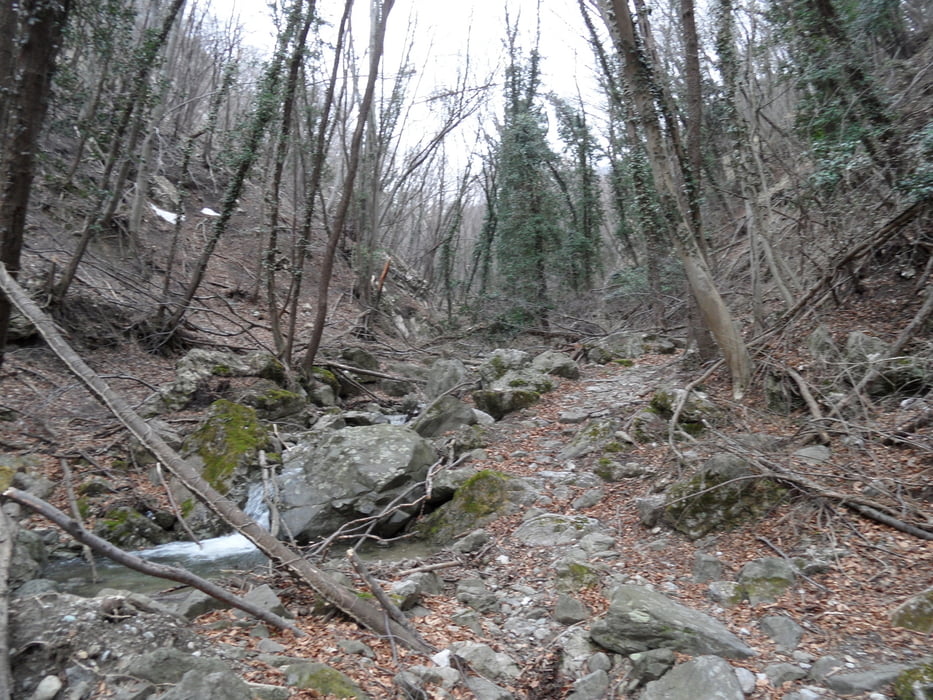
auf der Sp60 von Toirano zum Paß "Giogo di Toirano". 200m davor beginnt der "Sentiero Natura Rio del Valle". Ein alter, weitgehend gepflasterter, Eselweg durch das wilde Flußtal Richtung Toirano. Der Weg hat 600hm und ist vom Zahn der Zeit teilweise stark mitgenommen.
Die Schwierigkeit ist S2, teilweise S1. Man sollte jedoch mit großen Steinen des Pflasters, insbesondere in den Kehren, zurechtkommen. Im Frühjahr liegt oft noch Holz und lose Steine im Weg.
Da die Strecke auf 200m Seehöhe endet (bei der großen Brücke) folgt eine weitere Auffahrt von 500hm zum Sentiero Alte Terre.:
Zweite Tour:
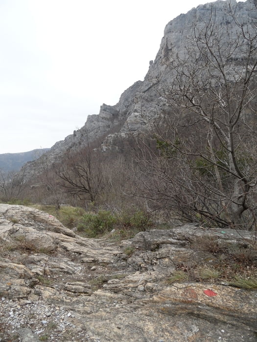
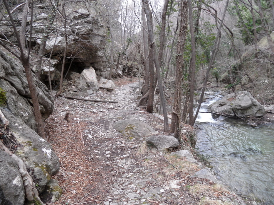
Vom Ende des ersten Trails wieder die Sp60 hinauf bis zum Ende von Campe (auf 400m). Dann ein Nebenweg, der zum Schluß immer schlechter wird bis Rocca Barbene (auf 710m). Von hier auf dem "Sentiero Alte Terre" nach Toirano. Anfangs ein schmaler Fahrweg bis zum Abzweig nach Ballestino - Hier könnte man alternativ auf Güterweg ins Tal abfahren.
Dann beginnt (eigentlich schon auf 500m) ein sehr schmaler markierter Pfad ins Tal, Schwierigkeit S2-S3. Der Weg ist recht technisch. Es liegen partiell einige Steine im Weg (rausräumen oder drüberfahren).
Bei Liguriabike.it hat es regionale Touren, soweit ich das sehe meist schwer. Ich vermute das meiste der Pfade der Gegend in OSM sind von denen - wenn auch ohne mtb Attribute - eingetragen.
Further information at
http://www.liguriabike.it/Tour gallery
Tour map and elevation profile
Minimum height 43 m
Maximum height 787 m
More about the tour author
|
|
skyhopper |
Comments

Parken am Tourstart in Toirano.
GPS tracks
Trackpoints-
GPX / Garmin Map Source (gpx) download
-
TCX / Garmin Training Center® (tcx) download
-
CRS / Garmin Training Center® (crs) download
-
Google Earth (kml) download
-
G7ToWin (g7t) download
-
TTQV (trk) download
-
Overlay (ovl) download
-
Fugawi (txt) download
-
Kompass (DAV) Track (tk) download
-
Track data sheet (pdf) download
-
Original file of the author (gpx) download
More about the tour author
|
|
skyhopper |
Add to my favorites
Remove from my favorites
Edit tags
Open track
My score
Rate