


Anspruchsvolle Endurotour mit technischer (verblockter) Abfahrt
Start in Loano oder Toirano. Auf SP60 bis Ortsende Cape (420m), dort links weiter auf Feldweg bis zur Bar Horsehaus... Weiter auf Feldweg zum Kirchlein oberhalb Toirano.
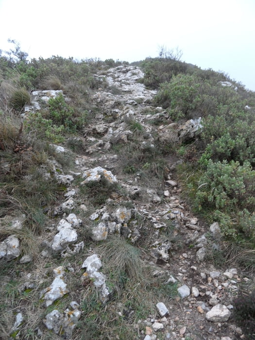
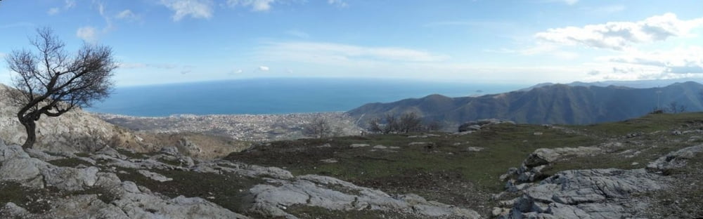
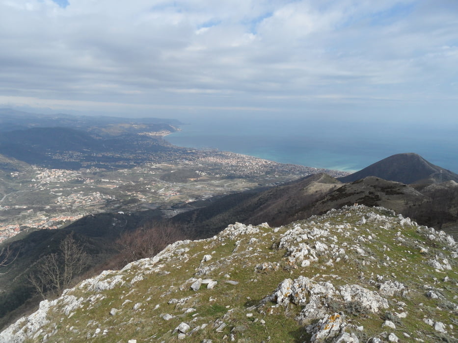
Ab hier dann bis zum Mt. Acuto auf und ab mit Laufanteilen (ca. 20min). Gleich nach der Kirche sieht man den typischen Charakter der Strecke, sehr felsig verblockt. Nichts für ungeübte, die werden sehr sehr viel schieben. Man muß schnell genug fahren, sonst bleibt man hängen. Ab dem Mt. Acuto (700m) eine sehr lange Abfahrt bis Loano. Für geübte ein wirklicher Spaß.
Tour gallery

Tour map and elevation profile
Minimum height 2 m
Maximum height 778 m
More about the tour author
|
|
skyhopper |
Comments

Parken in Loano oder in Toirano am Parkplatz an der Hauptstraße
GPS tracks
Trackpoints-
GPX / Garmin Map Source (gpx) download
-
TCX / Garmin Training Center® (tcx) download
-
CRS / Garmin Training Center® (crs) download
-
Google Earth (kml) download
-
G7ToWin (g7t) download
-
TTQV (trk) download
-
Overlay (ovl) download
-
Fugawi (txt) download
-
Kompass (DAV) Track (tk) download
-
Track data sheet (pdf) download
-
Original file of the author (gpx) download
More about the tour author
|
|
skyhopper |
Add to my favorites
Remove from my favorites
Edit tags
Open track
My score
Rate