


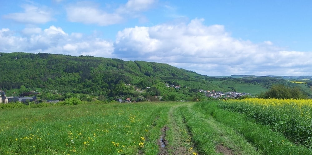
Alternative zur offiziellen Echternacher Mountainbike-Strecke. Mehr Waldwege und wenn Asphalt dann meistens steigend. Mittelschwere Tour. In beide Richtungen gut fahrbar. Die wenigen Trails sind nicht technisch, nur ein kurzer Abschnitt (steigend) mit Stufen.
Start Möglichkeiten: einer der Parkplätze beim Busbahnhof, alte Grenzbrücke oder bei der Jugendherberge.
Highlights:
- Mehrere Aussichtspunkte: Thull, Trooskneppchen (direkt oberhalb Echternach)
- Steigung „Haardt“ vom See: 3 Km und 200 HM
- Ruhe im Wald („Haard“) oberhalb vom See
- Steigung nach dem Radweg: Trail, einige wenige Stufen, bei Regen wird’s hier glatt…
- Viele Terrassen in Echternach
Bemerkung: Dieser Kommentar basiert auf eine Fahrtrichtung im Uhrzeigersinn. Die Strecke folgt nur Teile der ausgeschilderte Echternacher MTB Strecke, darum Diese nicht „automatisch“ folgen :-).
Tour gallery
Tour map and elevation profile
Minimum height 151 m
Maximum height 382 m
More about the tour author

|
luxgps |
Comments

GPS tracks
Trackpoints-
GPX / Garmin Map Source (gpx) download
-
TCX / Garmin Training Center® (tcx) download
-
CRS / Garmin Training Center® (crs) download
-
Google Earth (kml) download
-
G7ToWin (g7t) download
-
TTQV (trk) download
-
Overlay (ovl) download
-
Fugawi (txt) download
-
Kompass (DAV) Track (tk) download
-
Track data sheet (pdf) download
-
Original file of the author (gpx) download
More about the tour author
|
|
luxgps |
Add to my favorites
Remove from my favorites
Edit tags
Open track
My score
Rate