


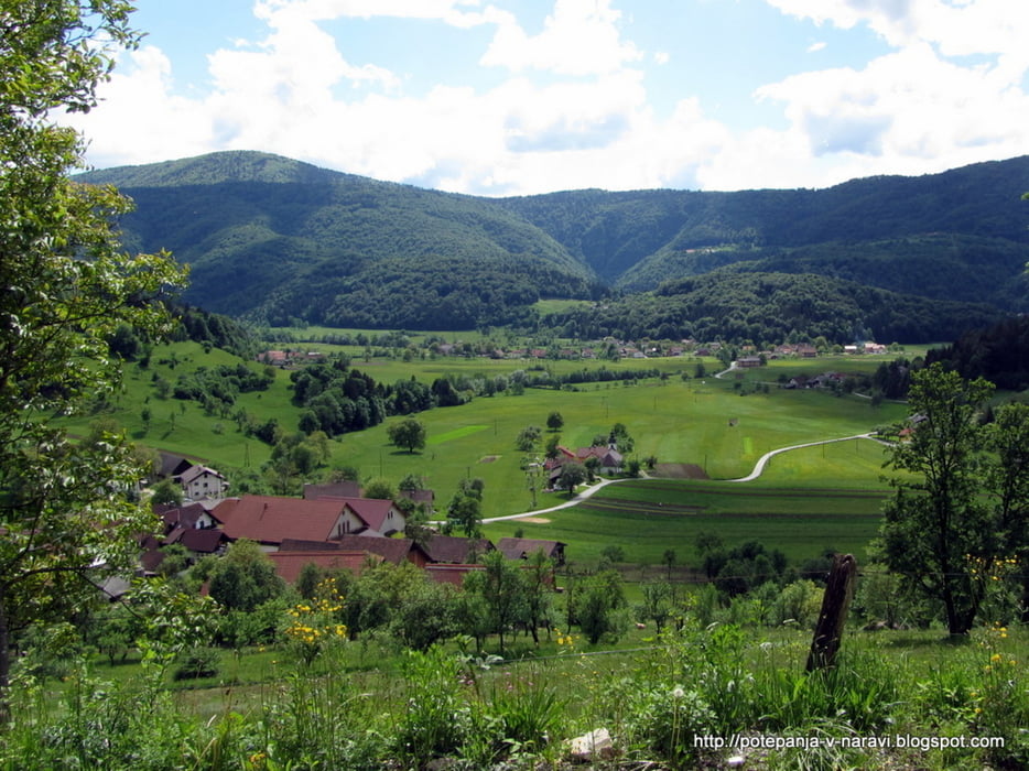
Vzpon na Krimšček nad Rakitno iz vasi Zabočevo.
Further information at
http://potepanja-v-naravi.blogspot.com/2013/05/krimscek.htmlTour gallery
Tour map and elevation profile
Minimum height 419 m
Maximum height 934 m
More about the tour author
|
|
ExAmigan |
Comments

V Borovnici zavijemo proti Peklu (levo iz smeri Podpeči) in po cesti nadaljujemo naravnost vse do Brezovice pri Borovnici, kjer pri kažipoti zavijemo levo v smeri Zabočevega. Zapeljemo se skozi vas do makadamske ceste in naprej dokler na desni ne ugledamo kažipota za Rakitno. Nato ob prvi priložnosti parkiramo ob cesti.
GPS tracks
Trackpoints-
GPX / Garmin Map Source (gpx) download
-
TCX / Garmin Training Center® (tcx) download
-
CRS / Garmin Training Center® (crs) download
-
Google Earth (kml) download
-
G7ToWin (g7t) download
-
TTQV (trk) download
-
Overlay (ovl) download
-
Fugawi (txt) download
-
Kompass (DAV) Track (tk) download
-
Track data sheet (pdf) download
-
Original file of the author (gpx) download
More about the tour author
|
|
ExAmigan |
Add to my favorites
Remove from my favorites
Edit tags
Open track
My score
Rate