


Von Montaione über San Vivaldo, Castagno Val d'Elsa nach San Gimignano und zurück über Panicole, Pozzini, Badia a Cerreto und Gambassi Terme.
Zu Beginn in Montaione auf im Abstieg wie im Anstieg steilem und steinigem Wander-/MTB-Weg (evtl. kurze Abschnitte schieben; siehe Foto). Rest der Strecke asphaltierte oder schottrigen Nebenstraßen. Alternativ zum ersten Abschnitt könnte die Straße (SP26) genutzt werden.
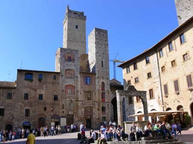
Insgesamt unschwierig, landschaftlich sehr reizvoll (sowohl Hin- wie auch Rückweg), San Gimignano ist eine kleine, recht interessante Stadt.
Zu Beginn in Montaione auf im Abstieg wie im Anstieg steilem und steinigem Wander-/MTB-Weg (evtl. kurze Abschnitte schieben; siehe Foto). Rest der Strecke asphaltierte oder schottrigen Nebenstraßen. Alternativ zum ersten Abschnitt könnte die Straße (SP26) genutzt werden.
Insgesamt unschwierig, landschaftlich sehr reizvoll (sowohl Hin- wie auch Rückweg), San Gimignano ist eine kleine, recht interessante Stadt.
Further information at
http://www.montaione.de/Tour gallery
Tour map and elevation profile
Minimum height 67 m
Maximum height 550 m
More about the tour author

|
LöhndorfBiker |
Comments
Von der Autobahn Pisa-Florenz über San Miniato oder Castelfiorentino nach Montaione.
GPS tracks
Trackpoints-
GPX / Garmin Map Source (gpx) download
-
TCX / Garmin Training Center® (tcx) download
-
CRS / Garmin Training Center® (crs) download
-
Google Earth (kml) download
-
G7ToWin (g7t) download
-
TTQV (trk) download
-
Overlay (ovl) download
-
Fugawi (txt) download
-
Kompass (DAV) Track (tk) download
-
Track data sheet (pdf) download
-
Original file of the author (gpx) download
More about the tour author
|
|
LöhndorfBiker |
Add to my favorites
Remove from my favorites
Edit tags
Open track
My score
Rate
Attenzione/attention
Circa a metà percorso (mi scuso ma non posso essere più preciso) il sentiero non esiste più e si finisce in mezzo alle spine ed ai rovi invalicabili.
Attention :
in the middle of the tripp (sorry I can't be more precise) the path has disappeared and now there are only insuperable thorns and brambles