


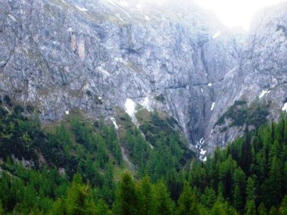
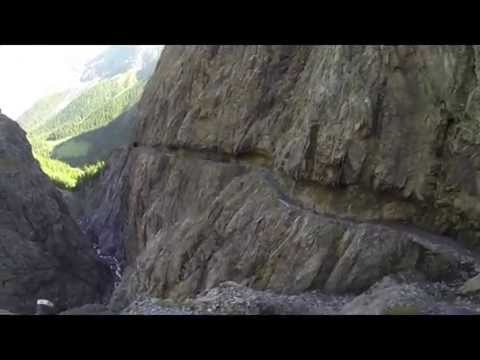
Diese Transalp Etappe für Mountainbiker für durch das Val d`Uina von Sur En im Unterengadin über die Uina Dadaint und die Uina-Schlucht zur Hochebene Alp Sursass. Von der Alp Sursass führt der Trail weiter über die grüne Grenze zwischen der Schweiz und Italien und weiter zur Sesvennahütte und die alte Pforzheimer Hütte ins Vinschgau nach Mals.
Auf dieser Tour kann man sowohl an der Uina Dadaint ( nach ca. 2 Stunden ) oder an der Sesvennahütte ( nach ca. 3,5 Stunden ) eine kleine Rast einlegen.
Further information at
http://transalp-veranstalter.de/Tour gallery


Tour map and elevation profile
Minimum height 906 m
Maximum height 2311 m
More about the tour author

|
Daniel82 |
Comments

Die Anfahrt nach Sur En erfolgt über die Inntalstraße. In Höhe von Ramosch zweigt eine kleine Straße zum Campingplatz Sur En ab.
GPS tracks
Trackpoints-
GPX / Garmin Map Source (gpx) download
-
TCX / Garmin Training Center® (tcx) download
-
CRS / Garmin Training Center® (crs) download
-
Google Earth (kml) download
-
G7ToWin (g7t) download
-
TTQV (trk) download
-
Overlay (ovl) download
-
Fugawi (txt) download
-
Kompass (DAV) Track (tk) download
-
Track data sheet (pdf) download
-
Original file of the author (gpx) download
More about the tour author
|
|
Daniel82 |
Add to my favorites
Remove from my favorites
Edit tags
Open track
My score
Rate