


Tourendatum: 27.07.2013
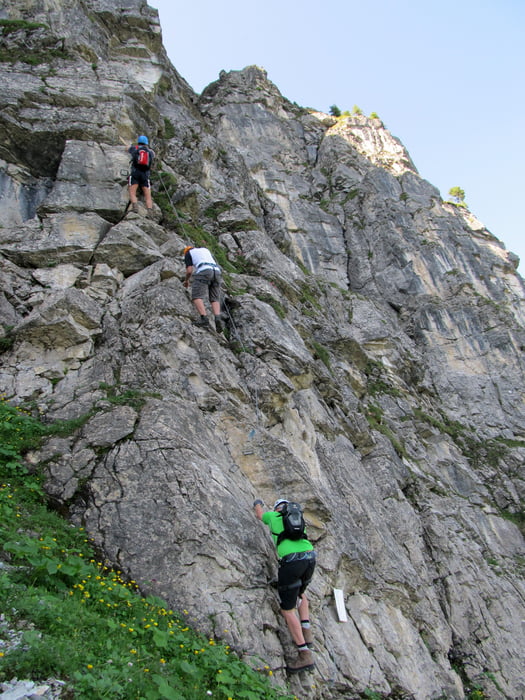
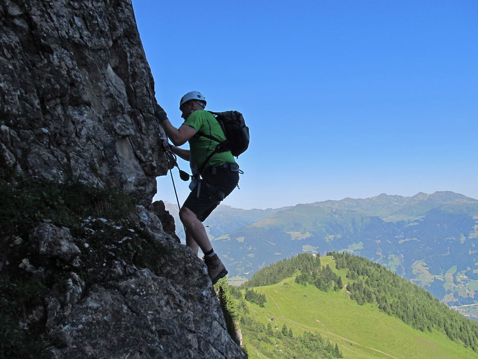
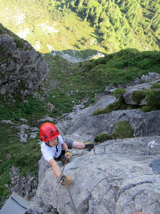
Tourencharakter: Schattseitiger Klettersteig, ideal an heissen Tagen, durchgehend interessante Kletterei, max. Schwierigkeit D (2 Stellen), sonst meist C und C/D, 240 Hm vom Einstieg. Insgesamt ca. 600 Hm von Bergstation.
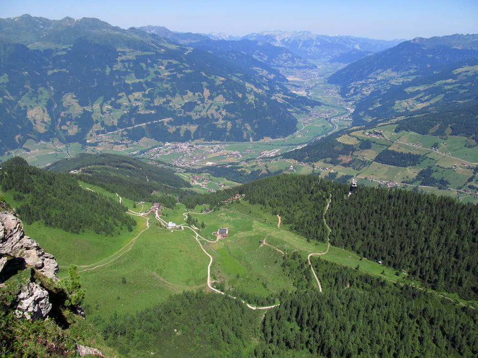
Tourenverlauf: Vom PP der Gerlossteinbahn (920) mit der Seilbahn in ca. 7 Min. zur Bergstation (1620). Von dort auf beschildertem Weg zum Einstieg der sichtbaren N-Wand des Gerlossteins (ca. 30 Min). Durch die stets schattige Wand den Klettersteig empor bis zum Ausstieg nahe des Gipfelkreuzes (ca. 1,5-2h, 2166m). Dort oben hat man eine herrliche Aussicht ins Zillertal und auf manche Gletscherberge der Zillertaler Alpen. Abstieg erfolgte über den W-seitigen Weg dem Kamm entlang und zurück zur Bergstation (ca. 1h).
Einkehrmöglichkeiten: Restaurant Gerlosstein nahe Bergstation, Gerlosteinalm nahe Bergstation
Gerlossteinbahn startet um 8:30, dann halbstündige Fahrten
Further information at
http://www.zillertalarena.com/de/arena/sommer/klettersteig.htmlTour gallery
Tour map and elevation profile
Minimum height 899 m
Maximum height 2167 m
More about the tour author
|
|
Eimy |
Comments

Inntalautobahn - Ausfahrt Wiesing/Zillertal - ins Zillertal bis Zell am Ziller - Gerlospassstraße hochfahren bis Hainzenberg - PP Gerlossteinbahn
GPS tracks
Trackpoints-
GPX / Garmin Map Source (gpx) download
-
TCX / Garmin Training Center® (tcx) download
-
CRS / Garmin Training Center® (crs) download
-
Google Earth (kml) download
-
G7ToWin (g7t) download
-
TTQV (trk) download
-
Overlay (ovl) download
-
Fugawi (txt) download
-
Kompass (DAV) Track (tk) download
-
Track data sheet (pdf) download
-
Original file of the author (gpx) download
More about the tour author
|
|
Eimy |
Add to my favorites
Remove from my favorites
Edit tags
Open track
My score
Rate