


Tag 3: Pfelders – Meraner Hütte
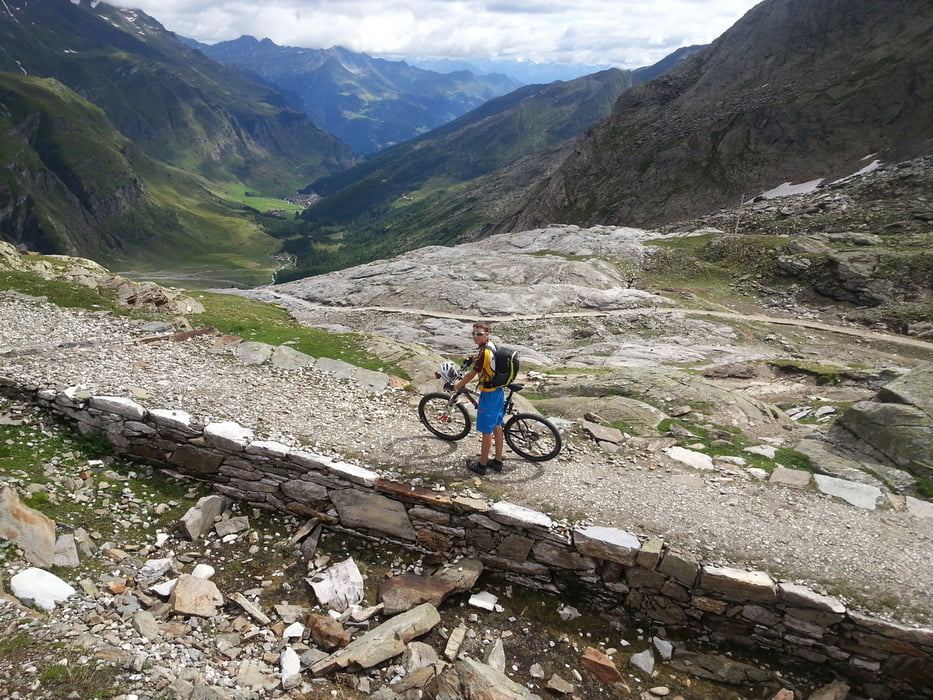
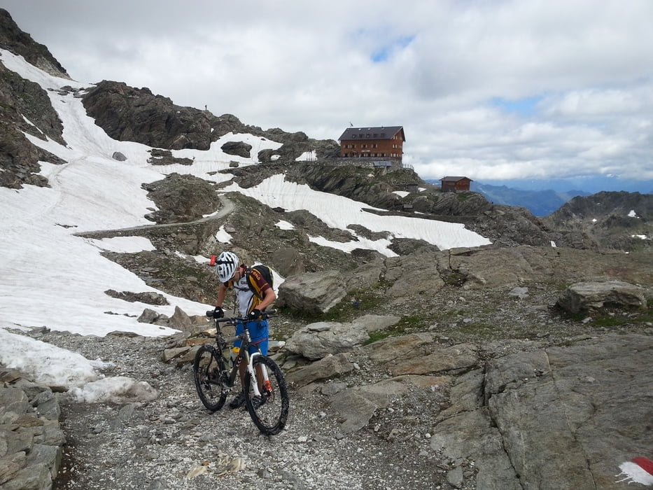
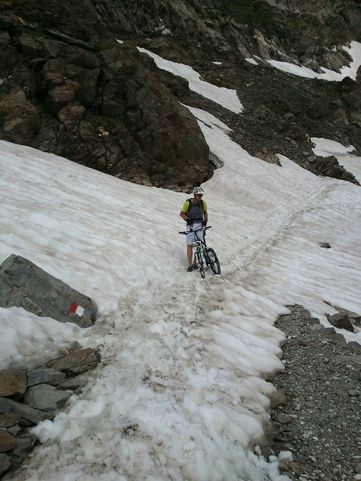
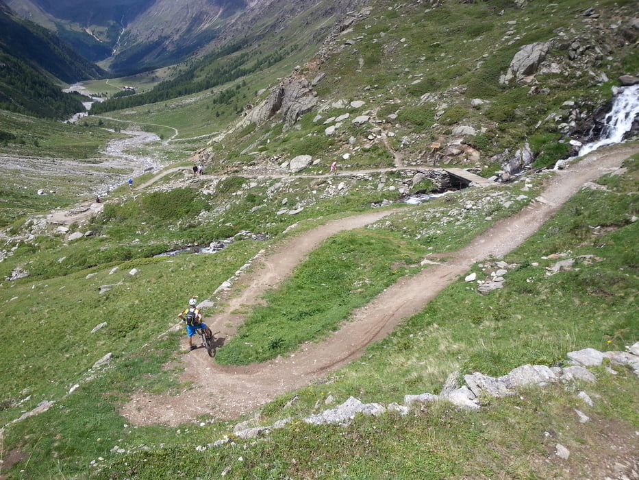
Ein Highlight, auch weil das Wetter mitgespielt hat. Zunächst geht es bis zur Lazinser Alm auf Schotter, die zu erzwingende Felswand stets im Blick. Ab hier heißt es dann ca. 1.000 hm (mit kurzen fahrbaren Unterbrechungen, dafür aber ohne Tragepassagen) schieben! Zunächst bis zur Stettiner Hütte und von dort über letzte Schneefelder rauf aufs Eisjöchl. Die Abfahrt vom Eisjöchl bis zum Eishof ist ein absolutes Highlight dieser Tour und macht riesig Spaß, auch wenn sehr viele, aber durchweg freundliche Wanderer unterwegs waren. Ab dem Eishof geht es weiter durch unzählige Gatter ins Schnalstal und von dort auf Asphalt hinunter nach Naturns, dann geht es weiter auf dem Etschtalradweg bis Meran. Bei 36° fuhren wir mitten durch die Stadt bis zur Talstation Meran 2000 und gönnten uns den Aufstieg (ca. 1.100hm) mit der Gondel, wo wir von der Bergstation noch ca. 45 min und 200 hm bis zum Meraner Haus, unserer dritten Station zurücklegen mussten.
Tour gallery

Tour map and elevation profile
Minimum height 297 m
Maximum height 2910 m
More about the tour author
|
|
harogo |
Comments

GPS tracks
Trackpoints-
GPX / Garmin Map Source (gpx) download
-
TCX / Garmin Training Center® (tcx) download
-
CRS / Garmin Training Center® (crs) download
-
Google Earth (kml) download
-
G7ToWin (g7t) download
-
TTQV (trk) download
-
Overlay (ovl) download
-
Fugawi (txt) download
-
Kompass (DAV) Track (tk) download
-
Track data sheet (pdf) download
-
Original file of the author (gpx) download
More about the tour author
|
|
harogo |
Add to my favorites
Remove from my favorites
Edit tags
Open track
My score
Rate