
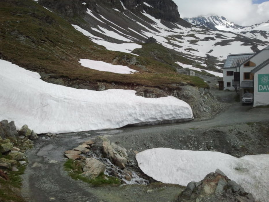

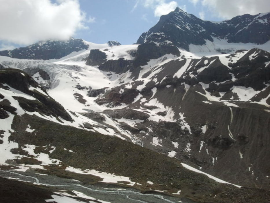
From Galtür first to Wirl on gravel and asphalt. From Wirl on gravel towards Bielerhöhe and Silvretta Reservoir, gently climbing, more or less parallel to the main road. Watch out for the cows! At the reservoir along the shore towards the walking path to the Wiesbadener Hütte. The climb to the hut starts gently, on a walking path, climbing in a valley along the stream. After some time the path becomes steeper and steeper, at some parts cycling is difficult because the path is very steep. Also stones and rocks are lying on the path, meaning that when you are cycling at these steep parts, you have to slalom between these stones. The rewards are high, as the valley has a beautiful scenery, and the view on the glacier is really worthwile, when coming closer towards the hut. Same way back to return to Galtür.
Tour gallery
Tour map and elevation profile
Minimum height 1594 m
Maximum height 2437 m
More about the tour author

|
benthumw |
Comments

GPS tracks
Trackpoints-
GPX / Garmin Map Source (gpx) download
-
TCX / Garmin Training Center® (tcx) download
-
CRS / Garmin Training Center® (crs) download
-
Google Earth (kml) download
-
G7ToWin (g7t) download
-
TTQV (trk) download
-
Overlay (ovl) download
-
Fugawi (txt) download
-
Kompass (DAV) Track (tk) download
-
Track data sheet (pdf) download
-
Original file of the author (gpx) download
More about the tour author
|
|
benthumw |
Add to my favorites
Remove from my favorites
Edit tags
Open track
My score
Rate