


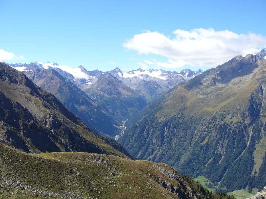
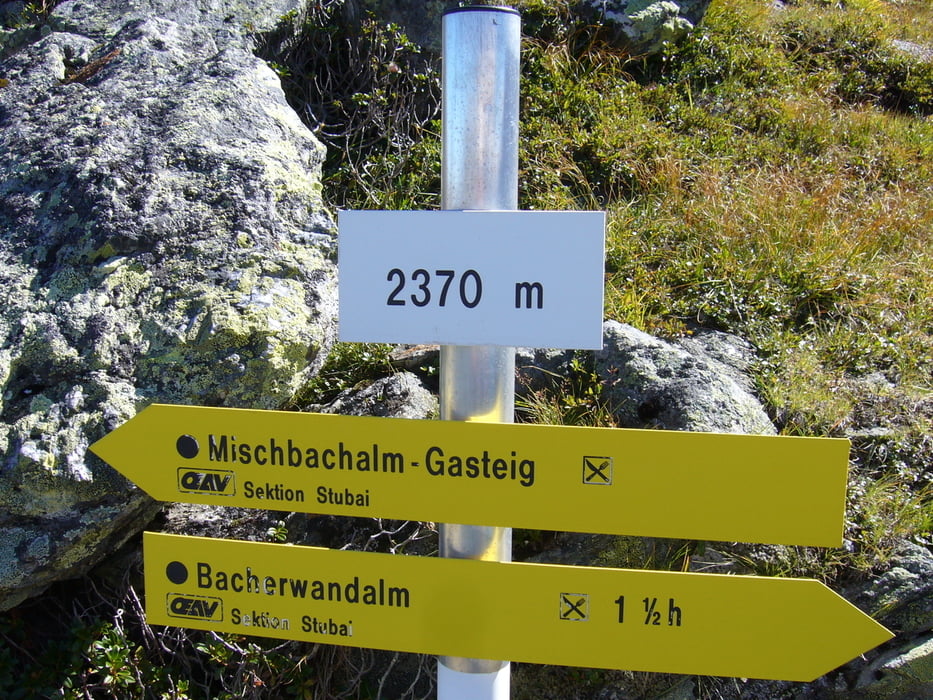
Wunderschöne Tour von Gasteig über die Bacherwandalm zum Glückgrat, von wo aus man einen herrlichen Blick ins Stubaital und auf den Gletscher hat. Absteig über die urige Mischbachalm zurück nach Gasteig.
Die Tour ist konditionell anstrengend, aber gut machbar. Die von uns gegangene Richtung ist m.E. die angenehmere, da der Abstieg vom Glücksgrat so gemäßigter ist.
Zu Beginn der Tour war der GPS-Empfang mäßig. Die "Delle" im Höhenprofil stimmt so nicht. Es geht bis zum Einstieg zur Bacherwandalm eher gemässigt aufwärts.
Tour gallery
Tour map and elevation profile
Minimum height 817 m
Maximum height 2334 m
More about the tour author

|
klixx |
Comments

GPS tracks
Trackpoints-
GPX / Garmin Map Source (gpx) download
-
TCX / Garmin Training Center® (tcx) download
-
CRS / Garmin Training Center® (crs) download
-
Google Earth (kml) download
-
G7ToWin (g7t) download
-
TTQV (trk) download
-
Overlay (ovl) download
-
Fugawi (txt) download
-
Kompass (DAV) Track (tk) download
-
Track data sheet (pdf) download
-
Original file of the author (gpx) download
More about the tour author
|
|
klixx |
Add to my favorites
Remove from my favorites
Edit tags
Open track
My score
Rate