


Ausgangspunkt ist der 4 Sterne Campimgplatz "Koren" in Kobarid. Wir mieteten uns ein Blockhaus und versorgten uns selbst, so ist uns die Woche sehr günstig gekommen. Von hier aus sind auch die meisten Tagestouren zu fahren. Die Touren bieten alles was zum Mtb gehört inklusive Trails die glaube ich auch Hardcoretrailfahrer zum absteigen zwingen!!
Einkehrmöglichkeiten gibt es nicht, wenn schon dann nur auf der italienischen Seite auf die wir fast jeden Tag gekommen sind. Jause mitnehmen!!
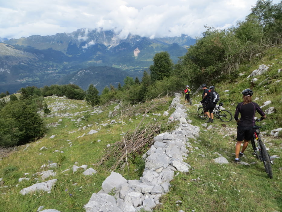
Sehr schöne Landschaft im Naturschutzgebiet Socatal.
mehr Bilder: seppdepp.heim.at
Tour gallery


Tour map and elevation profile
Minimum height 200 m
Maximum height 1517 m
More about the tour author
|
|
Atzbach |
Comments

GPS tracks
Trackpoints-
GPX / Garmin Map Source (gpx) download
-
TCX / Garmin Training Center® (tcx) download
-
CRS / Garmin Training Center® (crs) download
-
Google Earth (kml) download
-
G7ToWin (g7t) download
-
TTQV (trk) download
-
Overlay (ovl) download
-
Fugawi (txt) download
-
Kompass (DAV) Track (tk) download
-
Track data sheet (pdf) download
-
Original file of the author (gpx) download
More about the tour author
|
|
Atzbach |
Add to my favorites
Remove from my favorites
Edit tags
Open track
My score
Rate