Login

Forgot your login?

Cookies have to be accepted!
Your browser's cookie functionality is disabled. Please enable this functionality.

Not a member yet?

Register now
Login

Available for registred users only

Log in to use this feature.

Forgot your login?

Cookies have to be accepted!
Your browser's cookie functionality is disabled. Please enable this functionality.

Not a member yet?

Register now
Filter
Categories
Advanced filters
  • Distance (km)
  • Height
Save filters Reset filter

TrackRank

QRCode

Technical data

Distance18,9 km Height303 m Way down310 m Duration00:00 h:m Date10.09.2013
Scores Author Landscape Fun factor Fitness Technique

Statistics

167 Views Scores 25 Downloads Average
Rate
  • Track data sheet
  • Directions
  • Downloads

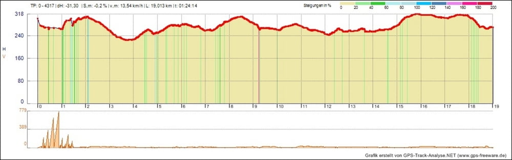
Eine kleine After-Work-Runde von knapp 20Km. Mit einigen kleinen Abfahrten, engere Trails und Auffahrten sind auch dabei.


Man bedenke....Ich bin kein Teenager mehr :-D
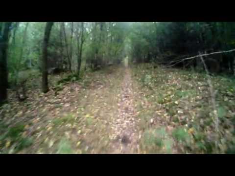
 

Tour gallery

Tour map and elevation profile

  • Open Street Map
  • Google
Minimum height 225 m Maximum height 319 m Detailed view

More about the tour author

JayKay666
Member since 2013

Send private message

Comments

Start Einfahrt Wagwiesental Parallelstraße Neunkirchen

GPS tracks

Trackpoints
  • GPX / Garmin Map Source (gpx) download
  • TCX / Garmin Training Center® (tcx) download
  • CRS / Garmin Training Center® (crs) download
  • Google Earth (kml) download
  • G7ToWin (g7t) download
  • TTQV (trk) download
  • Overlay (ovl) download
  • Fugawi (txt) download
  • Kompass (DAV) Track (tk) download
  • Track data sheet (pdf) download
  • Original file of the author (gpx) download

More about the tour author

JayKay666
Member since 2013

Send private message
Share track
Add to my favorites
Remove from my favorites
Edit tags
My score
Rate
Track: Kasbruck Furpach Runde
Type: Mountain bike
Distance: 18,9 km
Evaluated on:
Duration:
Day(s)
Hour(s)
Minute(s)
Score: Landscape Fun factor Fitness Technique