


Start und Ziel in Eschenlohe.
Durchs schöne Eschenlainetail mit drei kurzen, aber knackigen Anstiegen. Nach dem Abzweig kurz vor dem Walchensee noch 300Hm kontinuierlich bergan.
Danach Abfahrt nach Wallgau - alles gut zu fahren auf breiten Forstwegen.
Der zweite Anstieg wird belohnt mit der Einkehr zur Esterbergalm!
Danach rollt es z.T. richtig steil nach Garmisch und zurück nach Eschenlohe.
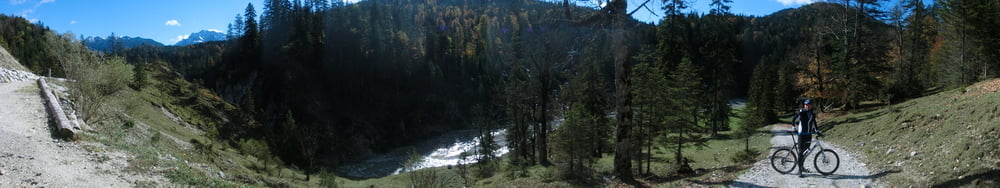
Tour gallery
Tour map and elevation profile
Minimum height 644 m
Maximum height 1308 m
More about the tour author
|
|
RuthLeuwerik |
Comments

Von Garmisch und Murnau über die Bundesstraße nach Eschenlohe. Parken beliebig. Zurück nach Eschenlohe eventuell auch per Bahn.
GPS tracks
Trackpoints-
GPX / Garmin Map Source (gpx) download
-
TCX / Garmin Training Center® (tcx) download
-
CRS / Garmin Training Center® (crs) download
-
Google Earth (kml) download
-
G7ToWin (g7t) download
-
TTQV (trk) download
-
Overlay (ovl) download
-
Fugawi (txt) download
-
Kompass (DAV) Track (tk) download
-
Track data sheet (pdf) download
-
Original file of the author (gpx) download
More about the tour author
|
|
RuthLeuwerik |
Add to my favorites
Remove from my favorites
Edit tags
Open track
My score
Rate