


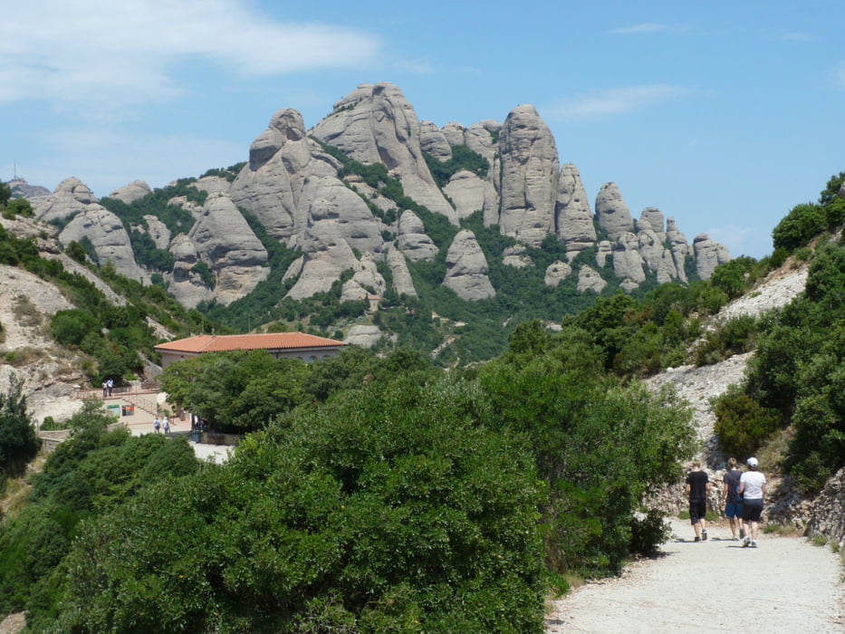
Eine Wandertour durch eine sehr schöne Berglandschaft. Tour beginnt am Kloster Montserrat und führt über einen gut begehbaren Wanderweg vorerst zur Kopfstation der Zahnradbahn,welche vom Kloster aus nach oben führt. Unterwegs Möglichkeit zu einem Abstecher zu einem Aussichtspunkt mit Sicht auf das Kloster (lohnt sich), s. Foto. Von der Kopfstation aus führt der Weg weiter durch wunderschöne Landschaft mit Blick auf das Umland zur Kapelle Sant Joan.Auch hier gibt es die Möglichkeit zu einem kleinen Abstecher zu ehemaligen Wohnhöhlen im Felsen oberhalb der Kapelle. Dieser Umweg ist teilweise steil und anstrengend, lohnt sich aber auch. Den Rückweg sind wir bis zur Station gelaufen und dann hinunter gefahren, da es sehr warm war und unsere Kondition nachließ. Wer nicht gerne bergauf wandert kann auch zuerst hochfahren und bergab wandern. Die Tour dauert mit beiden Abstechern und einmal Zahnradbahn etwa 3 Stunden.
Tour gallery


Tour map and elevation profile
Minimum height 719 m
Maximum height 1046 m
More about the tour author

|
Arktur |
Comments

Von Barcelona die Autobahn E 9 benutzen, bei Sant Vinec de Castellet abfahren,
Montserrat ist ausgeschildert.Mit dem Auto gleich bis hoch zum Kloster fahren,
es gibt genug Parkplätze (kostenpflichtig)
GPS tracks
Trackpoints-
GPX / Garmin Map Source (gpx) download
-
TCX / Garmin Training Center® (tcx) download
-
CRS / Garmin Training Center® (crs) download
-
Google Earth (kml) download
-
G7ToWin (g7t) download
-
TTQV (trk) download
-
Overlay (ovl) download
-
Fugawi (txt) download
-
Kompass (DAV) Track (tk) download
-
Track data sheet (pdf) download
-
Original file of the author (gpx) download
More about the tour author
|
|
Arktur |
Add to my favorites
Remove from my favorites
Edit tags
Open track
My score
Rate