


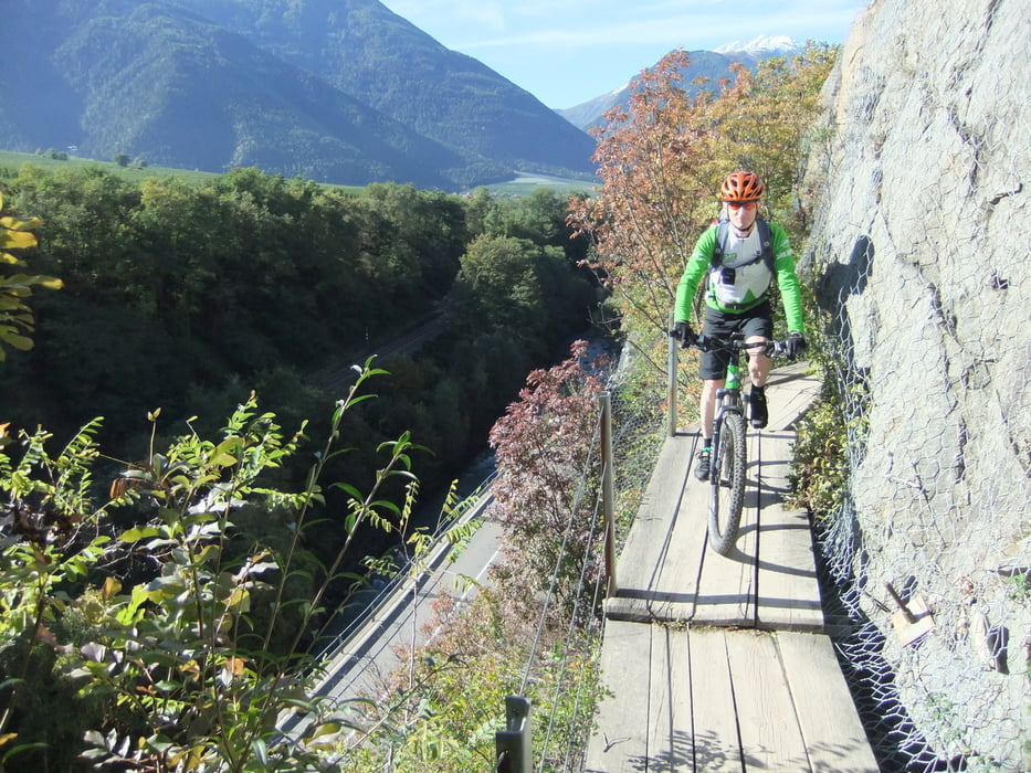
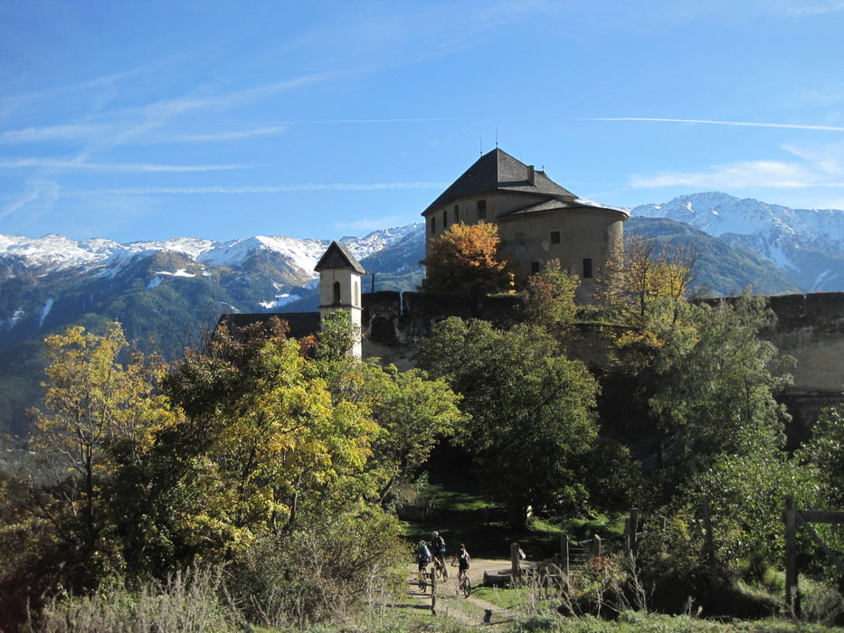
Von Schlanders aus entlang der Vinschgauerstrasse bis zum Abzweig nach Vezzan, hier hoch oberhalb Goldrain durch die Obstgärten , dann bergab nach Latsch (Einkaufsmöglichkeit), weiter auf dem alten Waalweg, bei Kastellbell fahren wir auf der Straße Richtung St. Martin weiter bis links Abzweigschild nach Goldrain kommt. Abfahrt Schwierigkeit bis S2, teilweise schieben. Der Weg führt am Schloß Annenberg vorbei bis Vezzan, ab hier gleiche Strecke zurück
Further information at
http://de.wikipedia.org/wiki/Schloss_AnnenbergTour gallery
Tour map and elevation profile
Minimum height 578 m
Maximum height 1519 m
More about the tour author

|
bergkine |
Comments

GPS tracks
Trackpoints-
GPX / Garmin Map Source (gpx) download
-
TCX / Garmin Training Center® (tcx) download
-
CRS / Garmin Training Center® (crs) download
-
Google Earth (kml) download
-
G7ToWin (g7t) download
-
TTQV (trk) download
-
Overlay (ovl) download
-
Fugawi (txt) download
-
Kompass (DAV) Track (tk) download
-
Track data sheet (pdf) download
-
Original file of the author (gpx) download
More about the tour author
|
|
bergkine |
Add to my favorites
Remove from my favorites
Edit tags
Open track
My score
Rate