


Einfache Schneeschuhwanderung mit geringer Lawinengefahr und viel Sonne.
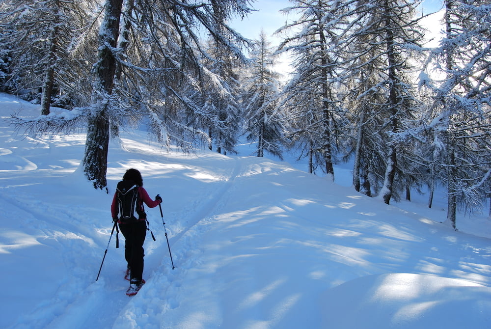
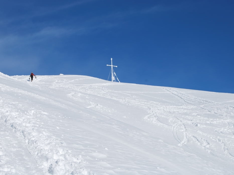
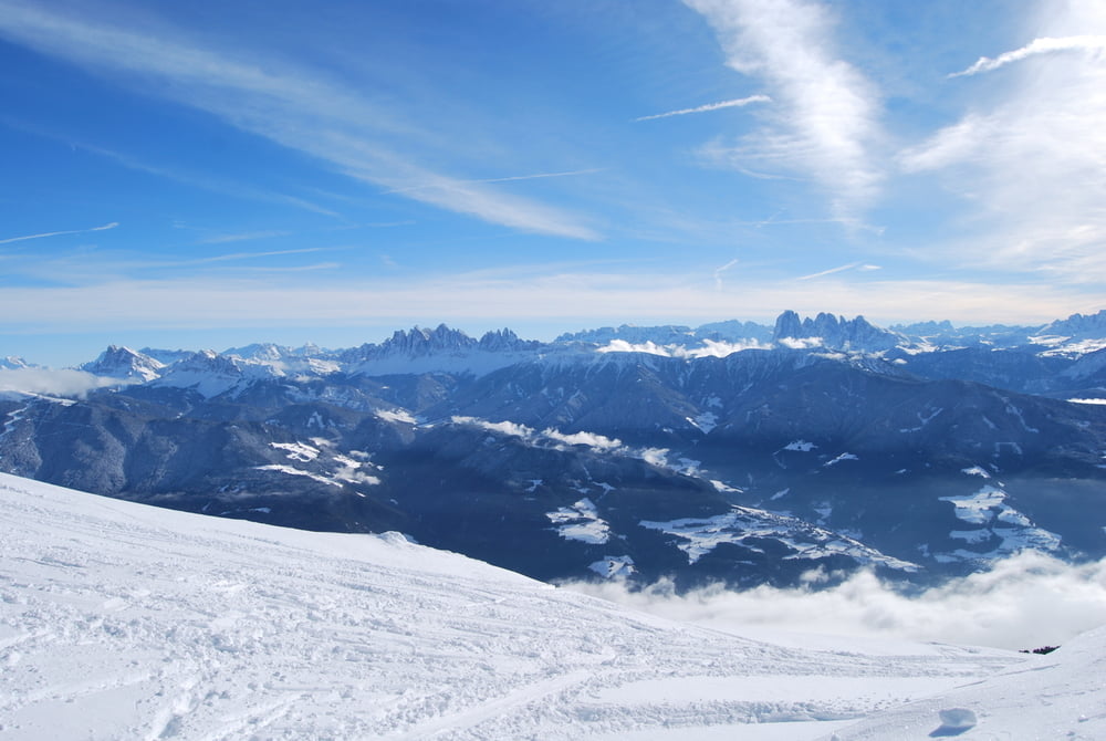
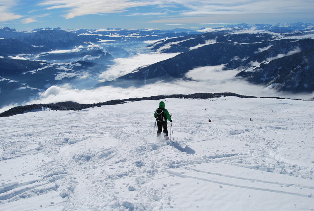
Am Ende des gebührenfreien Parkplatzes beim Kühhof (1587m) auf Forstweg Richtung Klausnerhütte und gleich rx durch lichten Lärchenwald empor bis zur Waldgrenze. Ab hier unschwierig über weites offenes Gelände und über leicht ansteigende Hänge bis zum Gipfel. Die Aussicht auf die Zillertaler Alpen und Dolomiten und.... ist überwältigend.
Abstieg wie Aufstieg
Bei Nebel ist die Orientierung im freien Gelände sehr schwierig
Einkehrmöglichkeit: keine (Brugger Schupfe Winter 2013/14 geschlossen.
Landkarte Tabacco Nr. 030
Further information at
http://www.eisacktal.com/de/Tour gallery
Tour map and elevation profile
Minimum height 1564 m
Maximum height 2431 m
More about the tour author
|
|
Califan |
Comments

Autobahnausfahrt Klausen - Feldthurns - Latzfons - hinter dem Dorf Abzweig rx (Hinweisschild Kühhof) weiter bis zum Parkplatz.
GPS tracks
Trackpoints-
GPX / Garmin Map Source (gpx) download
-
TCX / Garmin Training Center® (tcx) download
-
CRS / Garmin Training Center® (crs) download
-
Google Earth (kml) download
-
G7ToWin (g7t) download
-
TTQV (trk) download
-
Overlay (ovl) download
-
Fugawi (txt) download
-
Kompass (DAV) Track (tk) download
-
Track data sheet (pdf) download
-
Original file of the author (gpx) download
More about the tour author
|
|
Califan |
Add to my favorites
Remove from my favorites
Edit tags
Open track
My score
Rate