Login

Forgot your login?

Cookies have to be accepted!
Your browser's cookie functionality is disabled. Please enable this functionality.

Not a member yet?

Register now
Login

Available for registred users only

Log in to use this feature.

Forgot your login?

Cookies have to be accepted!
Your browser's cookie functionality is disabled. Please enable this functionality.

Not a member yet?

Register now
Filter
Categories
Advanced filters
  • Distance (km)
  • Height
Save filters Reset filter

TrackRank

QRCode

Technical data

Distance51,8 km Height1640 m Way down1670 m Duration02:52 h:m Date15.01.2014
Scores Author Landscape Fun factor Fitness Technique

Statistics

356 Views Scores 38 Downloads Average
Rate
  • Track data sheet
  • Directions
  • Downloads

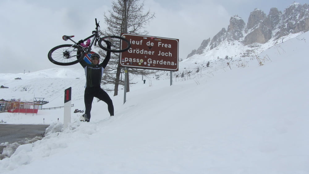
Klassische Sella Runde mit 4 Pässen.

Ich selbst bin mit dem Mountainbike gefahren, da ich kein Rennrad besitze. Geht aber auch mit dem Rennrad da alles Asphaltiert ist.


Tour gallery

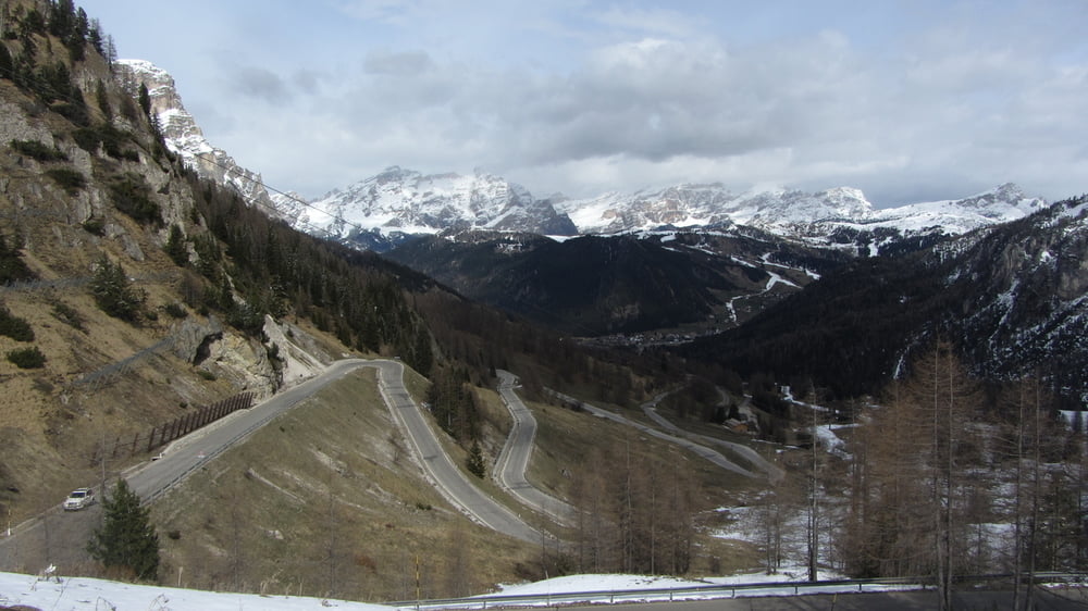
Tour map and elevation profile

  • Open Street Map
  • Google
Minimum height 1549 m Maximum height 2264 m Detailed view

More about the tour author

theheroblade
Member since 2010

Send private message

Comments

GPS tracks

Trackpoints
  • GPX / Garmin Map Source (gpx) download
  • TCX / Garmin Training Center® (tcx) download
  • CRS / Garmin Training Center® (crs) download
  • Google Earth (kml) download
  • G7ToWin (g7t) download
  • TTQV (trk) download
  • Overlay (ovl) download
  • Fugawi (txt) download
  • Kompass (DAV) Track (tk) download
  • Track data sheet (pdf) download
  • Original file of the author (gpx) download

More about the tour author

theheroblade
Member since 2010

Send private message
Share track
Add to my favorites
Remove from my favorites
Edit tags
My score
Rate
Track: Sella Rona Hardtail
Type: Mountain bike
Distance: 51,8 km
Evaluated on:
Duration:
Day(s)
Hour(s)
Minute(s)
Score: Landscape Fun factor Fitness Technique