Login

Forgot your login?

Cookies have to be accepted!
Your browser's cookie functionality is disabled. Please enable this functionality.

Not a member yet?

Register now
Login

Available for registred users only

Log in to use this feature.

Forgot your login?

Cookies have to be accepted!
Your browser's cookie functionality is disabled. Please enable this functionality.

Not a member yet?

Register now
Filter
Categories
Advanced filters
  • Distance (km)
  • Height
Save filters Reset filter

TrackRank

QRCode

Technical data

Distance4,5 km Height140 m Way down142 m Duration02:30 h:m Date16.03.2014
Scores Author Landscape Fun factor Fitness Technique

Statistics

240 Views Scores 45 Downloads Average
Rate
  • Track data sheet
  • Directions
  • Downloads

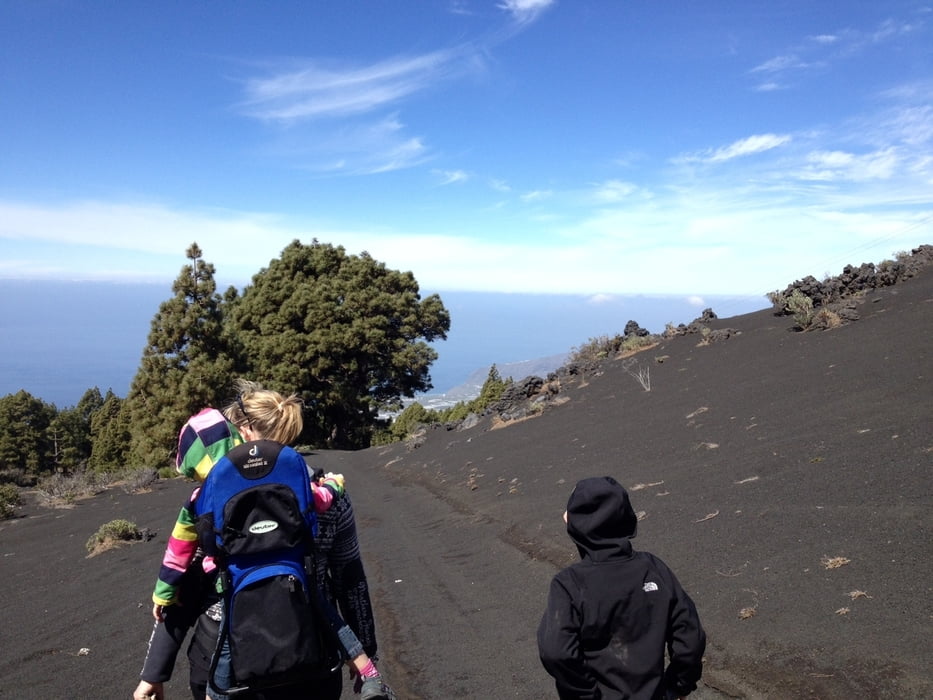
Kleine Wanderung in den Aschefeldern. Bestens geeignet für Kinder. Nur ein Stück ist etwas steil runter in der Asche


Further information at

http://www.hegibiketour.de

Tour gallery

Tour map and elevation profile

  • Open Street Map
  • Google
Minimum height 1135 m Maximum height 1275 m Detailed view

More about the tour author

hegi
Member since 2007

Send private message

Comments

Parken kann man am Rande der Straße zum El Pilar


GPS tracks

Trackpoints
  • GPX / Garmin Map Source (gpx) download
  • TCX / Garmin Training Center® (tcx) download
  • CRS / Garmin Training Center® (crs) download
  • Google Earth (kml) download
  • G7ToWin (g7t) download
  • TTQV (trk) download
  • Overlay (ovl) download
  • Fugawi (txt) download
  • Kompass (DAV) Track (tk) download
  • Track data sheet (pdf) download
  • Original file of the author (gpx) download

More about the tour author

hegi
Member since 2007

Send private message
Share track
Add to my favorites
Remove from my favorites
Edit tags
My score
Rate
Track: Mit Kindern in den Hexenfeldern wandern
Type: Hiking
Distance: 4,5 km
Evaluated on:
Duration:
Day(s)
Hour(s)
Minute(s)
Score: Landscape Fun factor Fitness Technique