


Der Radlteil steht gut beschrieben im Moser Bike Guide 2 Nr. 12.
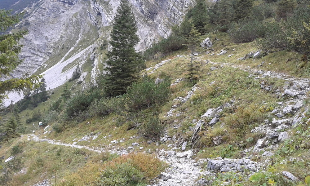
Für den Hiketeil sollte man das Rad an der Materialseilbahn stehen lassen. Weiter kann man auch nicht fahren. Ich habe jedoch das Rad bis zu den Soiernseen geschoben, weil ich mir es zugetraut habe, den Steig herunter zu fahren.
Aber Achtung!!
Dies ist ein Wandersteig, entsprechend haben Wanderer Vorrang und die Anforderungen sind sehr hoch!! Drum 5 Technik Sterne. Außerdem darf man keine Angst vorm Scheiben haben.
Der Rest zum Gipfel ist einen normale Wanderung.
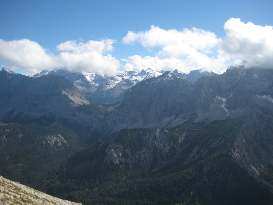
Oben wartet ein brillianter Blick ins nördliche Karwendel!! Außerdem hat da Kini nicht zufällig diesen Ort für seine Geburtstage ausgesucht ;-) (-> vgl. Wikipedia)
Tour gallery

Tour map and elevation profile
Minimum height 792 m
Maximum height 2253 m
More about the tour author
|
|
Seebi |
Comments

Von München entweder über Garmisch oder übern Kesselberg nach Krün. Dort ist ein großer Parkplatz an der Isar.
GPS tracks
Trackpoints-
GPX / Garmin Map Source (gpx) download
-
TCX / Garmin Training Center® (tcx) download
-
CRS / Garmin Training Center® (crs) download
-
Google Earth (kml) download
-
G7ToWin (g7t) download
-
TTQV (trk) download
-
Overlay (ovl) download
-
Fugawi (txt) download
-
Kompass (DAV) Track (tk) download
-
Track data sheet (pdf) download
-
Original file of the author (gpx) download
More about the tour author
|
|
Seebi |
Add to my favorites
Remove from my favorites
Edit tags
Open track
My score
Rate