

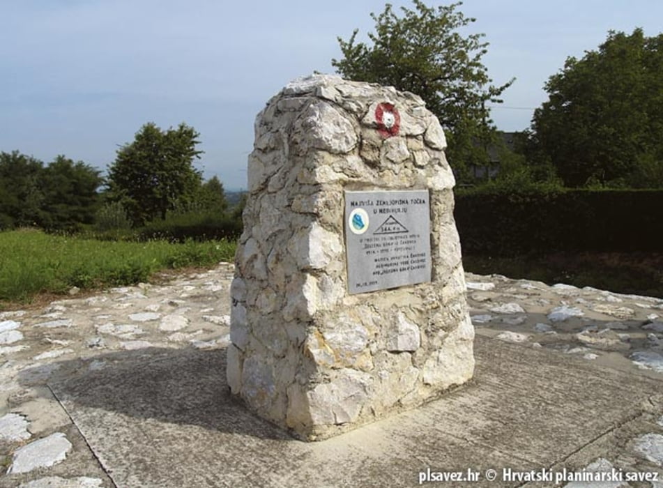
Osvajanje najvišeg vrha neke destinacije oduvijek je bio prestižan cilj među biciklistima pa tako ova ruta vodi do najvišeg vrha Međimurja. Premada 344 metara nadmorske visine ne djeluje impozantno, staza i osvajanje Mohokosa svakako nosi gomilu MTB adrenalina sa sobom. Do vrha vodi asfaltni i makadamski put a ruta nakon vrha vodi kroz šumarke i proplanke do Železne Gore. Povratak u Toplice Sveti Martin je po atraktivnoj “singlici” koja će vam razvuči osmijeh na lice.
To conquer the highest peak of one destination has always been a prestigious goal among cyclists This route is the one that leads to the highest peak of Međimurje. Although 344 meters of altitude difference does not seem like a lot of challenge, the trail itself and the bikers’ attempt to conquer Mohokosa certainly provide a lot of mountain bike adrenaline. There is a paved and gravel road that leads to the top, and once at the top the trail leads through woods and glades to Železna Gora. The return to Sveti Martin is at an attractive "single trail" that will put a huge smile on your face.
http://spa-sport.hr
http://www.adriabike.hr
Tour gallery
Tour map and elevation profile
Minimum height -35 m
Maximum height 144 m
More about the tour author
|
|
AdriaBikeHotels |
Comments

GPS tracks
Trackpoints-
GPX / Garmin Map Source (gpx) download
-
TCX / Garmin Training Center® (tcx) download
-
CRS / Garmin Training Center® (crs) download
-
Google Earth (kml) download
-
G7ToWin (g7t) download
-
TTQV (trk) download
-
Overlay (ovl) download
-
Fugawi (txt) download
-
Kompass (DAV) Track (tk) download
-
Track data sheet (pdf) download
-
Original file of the author (gpx) download
More about the tour author
|
|
AdriaBikeHotels |
Add to my favorites
Remove from my favorites
Edit tags
Open track
My score
Rate