


3.2.2008
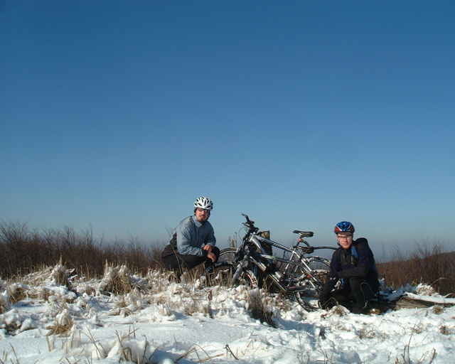
Konečne pekný slnečný deň, tak sme vyrazili na Babu po včerajšom neúspešnom pokuse. Tam sme dorazili čistí (sneh bol od Somára skoro po Babu), ale po ceste späť sa sneh roztopil aj polo zamrznuté bahno a boli sme ako "prasce". Výjazd na Čmeľok sme nedali, museli sme vytlačiť, brutálne stúpanie a bahno, potom sneh a výmole. Pri Snežienke (stanica lanovky) som zistil defekt (skoro vyfučané koleso), tak som menil dušu.
Konečne pekný slnečný deň, tak sme vyrazili na Babu po včerajšom neúspešnom pokuse. Tam sme dorazili čistí (sneh bol od Somára skoro po Babu), ale po ceste späť sa sneh roztopil aj polo zamrznuté bahno a boli sme ako "prasce". Výjazd na Čmeľok sme nedali, museli sme vytlačiť, brutálne stúpanie a bahno, potom sneh a výmole. Pri Snežienke (stanica lanovky) som zistil defekt (skoro vyfučané koleso), tak som menil dušu.
Tour gallery
Tour map and elevation profile
Minimum height 69 m
Maximum height 724 m
More about the tour author
|
|
tmax |
Comments

Bratislava**/*** - BA-Nové Mesto*** - BA-Rača*** - Biely kríž** - Salaš* - Kozí chrbát* - Somár* - Konské hlavy* - Pezinská Baba* - Čmeľok* - Pezinská Baba* - Konské hlavy* - Somár* - Kozí chrbát* - Salaš* - Biely kríž* - Červený kríž** - Železná studnička** - Tesco Lamač*** - BA-Karlova Ves
*turistická značka alebo lesný chodník mimo cestu
**cyklotrasa
***cesta s premávkou, asfaltka
*turistická značka alebo lesný chodník mimo cestu
**cyklotrasa
***cesta s premávkou, asfaltka
GPS tracks
Trackpoints-
GPX / Garmin Map Source (gpx) download
-
TCX / Garmin Training Center® (tcx) download
-
CRS / Garmin Training Center® (crs) download
-
Google Earth (kml) download
-
G7ToWin (g7t) download
-
TTQV (trk) download
-
Overlay (ovl) download
-
Fugawi (txt) download
-
Kompass (DAV) Track (tk) download
-
Track data sheet (pdf) download
-
Original file of the author (g7t) download
More about the tour author
|
|
tmax |
Add to my favorites
Remove from my favorites
Edit tags
Open track
My score
Rate