Login

Forgotten password?

Cookies have to be accepted!
Your browser's cookie functionality is disabled. Please enable this functionality.

Not a member yet?

Register now
Login

Available for registred users only

Log in to use this feature.

Forgotten password?

Cookies have to be accepted!
Your browser's cookie functionality is disabled. Please enable this functionality.

Not a member yet?

Register now
Filter
Categories
Advanced filters
  • Distance (km)
  • Height
Save filters Reset filter

TrackRank

QRCode

Technical data

Distance7,4 km Height492 m Way down481 m Duration02:30 h:m Date15.07.2014
Scores Author Landscape Fun factor Fitness Technique

Statistics

1027 Views Scores 70 Downloads Average
Rate
  • Track data sheet
  • Directions
  • Downloads

Direkt vom Ortskern in Calenzana zunächst der Beschilderung des GR 20 folgen. Nach etwa 20 Minuten kommt ein Abzweig Boucle di u Pratu (lila Markierung), dem man folgt bis man wieder auf den GR 20 stößt und auf diesem zurück nach Calenzana gelangt.

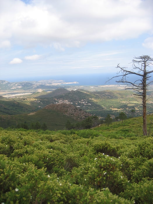
Tolle Ausblicke über die Balagne und die Bucht von Calvi.

Tour gallery

Tour map and elevation profile

  • Open Street Map
  • Google
Minimum height 264 m Maximum height 727 m Detailed view

More about the tour author

sstraesser
Member since 2012

Send private message

Comments

GPS tracks

Trackpoints
  • GPX / Garmin Map Source (gpx) download
  • TCX / Garmin Training Center® (tcx) download
  • CRS / Garmin Training Center® (crs) download
  • Google Earth (kml) download
  • G7ToWin (g7t) download
  • TTQV (trk) download
  • Overlay (ovl) download
  • Fugawi (txt) download
  • Kompass (DAV) Track (tk) download
  • Track data sheet (pdf) download
  • Original file of the author (gpx) download

More about the tour author

sstraesser
Member since 2012

Send private message
Share track
Add to my favorites
Remove from my favorites
Edit tags
My score
Rate
Track: Boucle di u Pratu
Type: Hiking
Distance: 7,4 km
Evaluated on:
Duration:
Day(s)
Hour(s)
Minute(s)
Score: Landscape Fun factor Fitness Technique