


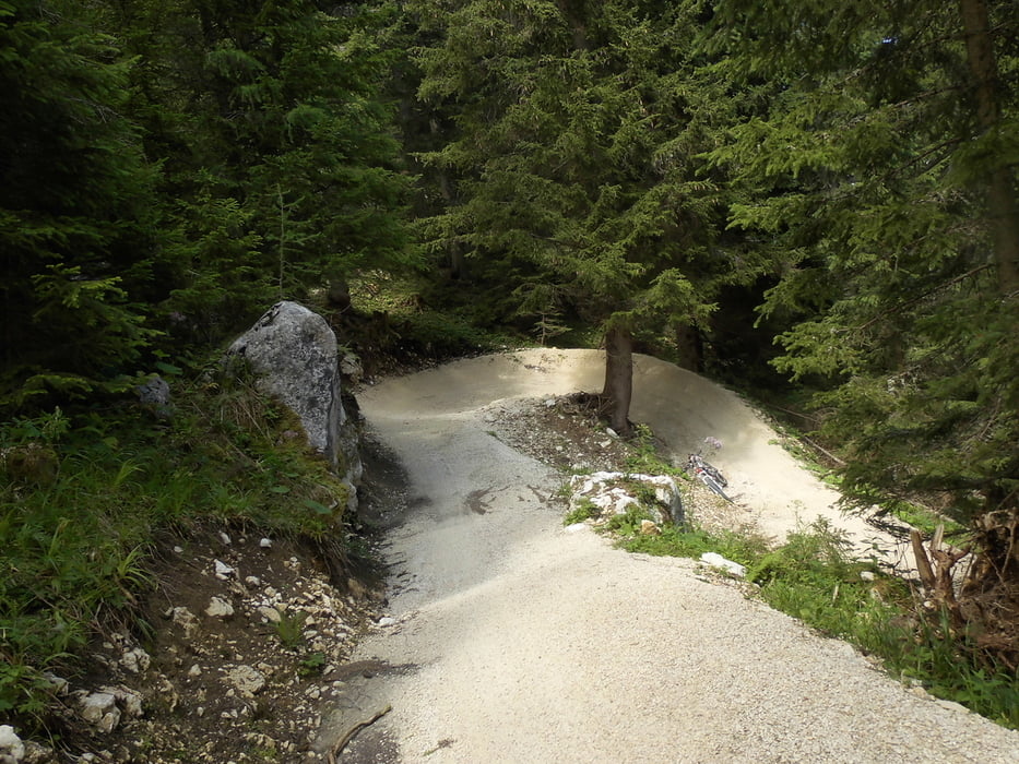
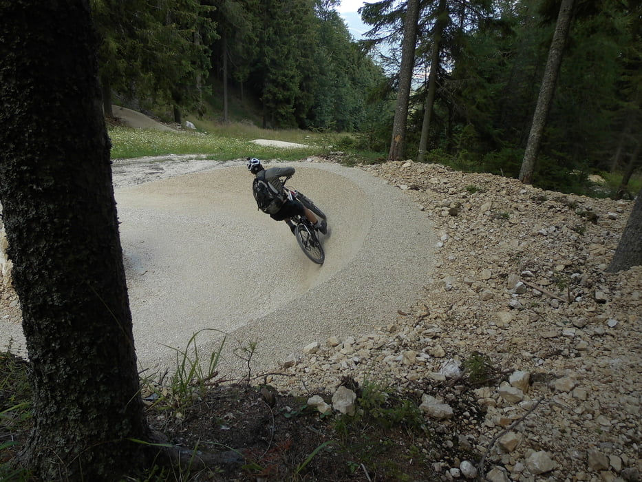
Es gibt Orte wo ein Mountainbiker gewesen sein sollte. Z.B. Val de Una, Brenner Grenzkammstraße und nun auch den Petzen Cross-Countrytrail. 1200 Höhenmeter Steilkurfen, Sprünge und eine Menge flow. Wenn man langsam fährt ist er einfach, die Schwierigkeit steigt mit der Geschwindikeit. Man kann sich eine Halbtagskarte an der Gondel kaufen und nur die Abfahrt genießen oder mit dem Rad am Stück 1200 Hm auf Forststraßen hoch radeln.
Tour gallery


Tour map and elevation profile
Minimum height 586 m
Maximum height 1720 m
More about the tour author

|
Bruno174 |
Comments

Autobahn Klagenfurt-Graz Abfahrt Treffen und dann nach Bleiberg-Petzenbahn Talstation.
GPS tracks
Trackpoints-
GPX / Garmin Map Source (gpx) download
-
TCX / Garmin Training Center® (tcx) download
-
CRS / Garmin Training Center® (crs) download
-
Google Earth (kml) download
-
G7ToWin (g7t) download
-
TTQV (trk) download
-
Overlay (ovl) download
-
Fugawi (txt) download
-
Kompass (DAV) Track (tk) download
-
Track data sheet (pdf) download
-
Original file of the author (gpx) download
More about the tour author
|
|
Bruno174 |
Add to my favorites
Remove from my favorites
Edit tags
Open track
My score
Rate