

Sehr schöne und anspruchsvoll Tagestour über den Neckarsteig im Neckartal.
Man kommt an Burgen, vorbei und es gibt viele schöne aber auch anspruchsvolle Trailabschnitte.
Am Ende sind wir durch die Margarethenschlucht, was ich aber in dem Track schon geändert habe. Diese ist zwar sehr schön aber kann nur runter getragen werden außer ihr seid Trailbiker und könnt runter hüpfen.. aber selbst das wird schwer.
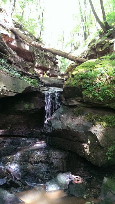
Das Bild ist aus der Magerethenschlucht(ein kurzes reinlaufen lohnt sich).
Tour map and elevation profile
Minimum height 134 m
Maximum height 342 m
More about the tour author
|
|
masterd28 |
Comments

GPS tracks
Trackpoints-
GPX / Garmin Map Source (gpx) download
-
TCX / Garmin Training Center® (tcx) download
-
CRS / Garmin Training Center® (crs) download
-
Google Earth (kml) download
-
G7ToWin (g7t) download
-
TTQV (trk) download
-
Overlay (ovl) download
-
Fugawi (txt) download
-
Kompass (DAV) Track (tk) download
-
Track data sheet (pdf) download
-
Original file of the author (gpx) download
More about the tour author
|
|
masterd28 |
Add to my favorites
Remove from my favorites
Edit tags
Open track
My score
Rate