


Hückelhoven - Doveren - Hetzerath - Granterath - Bellinghoven - Kuckum - Wanloo - Hochneukirchen - Schloss Dyck - Raketenstation Hombroich - Skihalle Neuss - Glehn - Odenkirchen - Wickerath - Bellinghoven - Granterrath - Hetzerath - Doveren - Hückelhoven
Die Tour führt nach Osten. Höhepunkte sind:
Über die Dörfer mit wenig Autoverkehr fährt man nach Neuss. Unterwegs passiert man bei Wanloo die Autobahn nach Mönchenglattbach (nicht falsch abbiegen!)
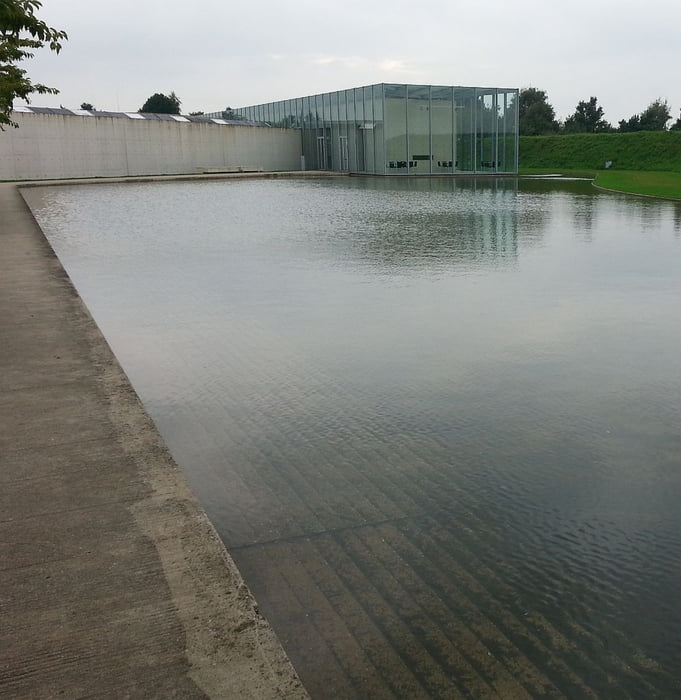
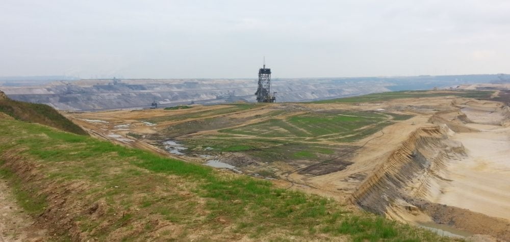
An hier beginnt nun das Tagebau Gebiet. Extra für Besucher ist ein Aussichtsplateu eingerichtet, von wo man Fotos schießen kann. Noch ein gutes Stück und man erreicht das Schloss Dyck. Wer es touristisch mag kann dort einen kurzen Stopp einlegen. Nach einer weiteren Autobahn Überquerung erreicht man die ehemalige Raketenstation. Viel zu sehen gibt es nicht. Wer moderne Architektur mag kann sich etwas von Ando ansehen.
Über die Dörfer und Schloss Wickerath zurück nach Bellinghoven und dann die bekannte Stecke nach Hückelhoven.
Further information at
http://de.wikipedia.org/wiki/Niederrhein_%28Region%29Tour gallery
Tour map and elevation profile
Minimum height 43 m
Maximum height 103 m
More about the tour author
|
|
messer1 |
Comments

Ausgangspunkt ist der Ort Hückelhoven. Am Gymnasium gibt es einen Parkplatz, allerdings ist dieser gebührenpflichtig bzw. mit Parkuhr für 2 Stunden frei.Für diese Tour wären die 2 Stunden ausreichend.
Alternativ kann man mit der Bahn anreisen. Von z.B. Düsseldorf ist es etwa 1h.
GPS tracks
Trackpoints-
GPX / Garmin Map Source (gpx) download
-
TCX / Garmin Training Center® (tcx) download
-
CRS / Garmin Training Center® (crs) download
-
Google Earth (kml) download
-
G7ToWin (g7t) download
-
TTQV (trk) download
-
Overlay (ovl) download
-
Fugawi (txt) download
-
Kompass (DAV) Track (tk) download
-
Track data sheet (pdf) download
-
Original file of the author (gpx) download
More about the tour author
|
|
messer1 |
Add to my favorites
Remove from my favorites
Edit tags
Open track
My score
Rate