

Dolomitenrunde mit Start und Ziel in St. Magdalena bei Villnöß.
Tag 1: St. Magdalena - St. Vigil (37km, 1600hm)
Tag 2: St. Vigil - St. Vigil (wegen Lage unserer Unterkunft leicht modifiziert: http://www.gps-tour.info/de/touren/detail.69055.html) (36km, 1575hm)
Tag 3: St. Vigil - Livinallongo (56km, 2100hm)
Tag 4: Livinallongo - St. Christina in Gröden (56km, 2100hm)
Tag 5: St. Christina - St. Magdalena (22km, 1000hm)
Wir hatten nicht gerade das beste Wetter (nachts 3 Grad und an Tag 1 und Tag 5 Regen), so dass der Boden tlw. sehr tief war. Die 1000hm Abfahrt vom Kronplatz (Tag 2) und die "Schlussabfahrt" an Tag 5 waren deswegen nur bedingt spaßig (nasse Wurzeln, tiefer Schlamm, ...). Für St. Vigil kann ich als Unterkunft Albergo Gader empfehlen. Essen top, Freundlichkeit genial. Die Tour ist stellenweise etwas straßenlastig (Passo Falzarego, Passo Pordoi, ...), was in Italien noch nerviger ist als bei uns, da dort keiner Rücksicht auf Radfahrer nimmt. Mit 30cm Abstand überholt werden, war fast schon Standard. Nichsdestotrotz meidet an Tag 3 unseren Weg über Pocol. Wir mussten gute 20 Minuten Schieben, da der Weg zu steil und nicht fahrbar war. Hier dann doch lieber Straße.
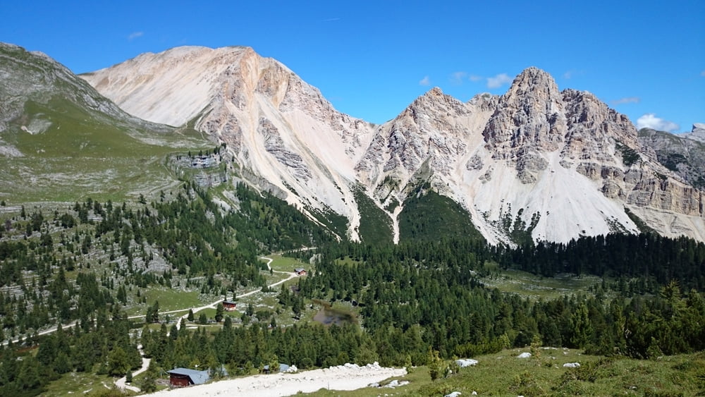
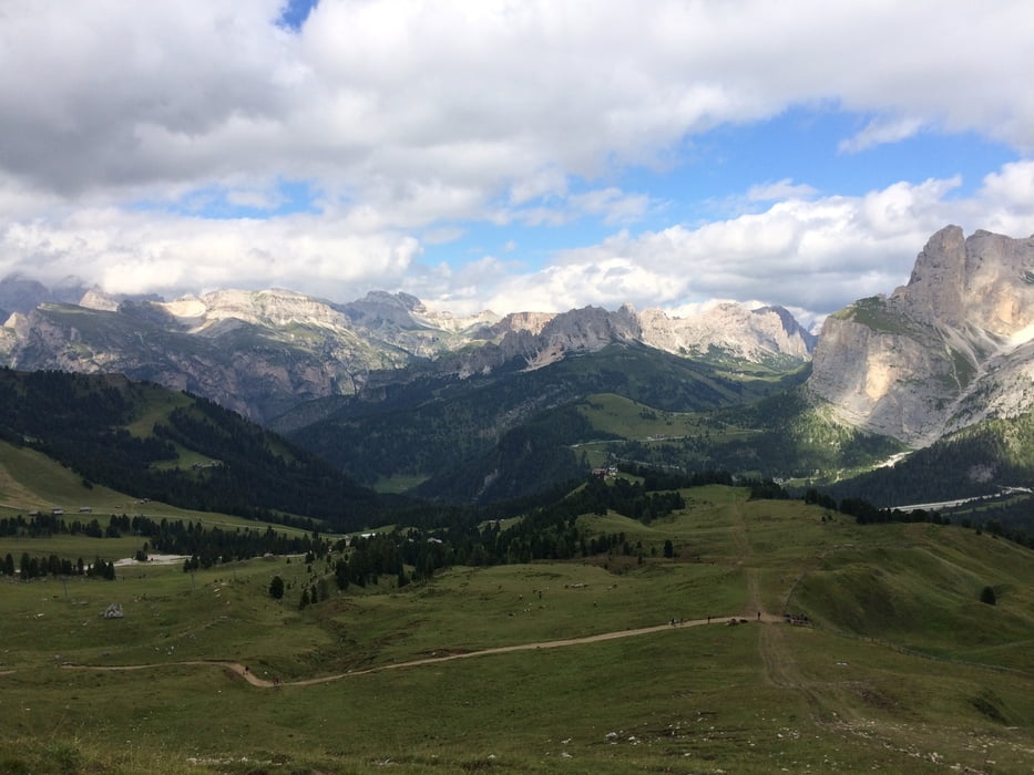
Landschaftlich ist die Tour top.
Tour gallery

Tour map and elevation profile
Minimum height 1008 m
Maximum height 2271 m
More about the tour author

|
klixx |
Comments

Bei Feldthurns von der Brennerautobahn ab und dann Richtung Villnöß.
GPS tracks
Trackpoints-
GPX / Garmin Map Source (gpx) download
-
TCX / Garmin Training Center® (tcx) download
-
CRS / Garmin Training Center® (crs) download
-
Google Earth (kml) download
-
G7ToWin (g7t) download
-
TTQV (trk) download
-
Overlay (ovl) download
-
Fugawi (txt) download
-
Kompass (DAV) Track (tk) download
-
Track data sheet (pdf) download
-
Original file of the author (gpx) download
More about the tour author
|
|
klixx |
Add to my favorites
Remove from my favorites
Edit tags
Open track
My score
Rate