Login

Forgot your login?

Cookies have to be accepted!
Your browser's cookie functionality is disabled. Please enable this functionality.

Not a member yet?

Register now
Login

Available for registred users only

Log in to use this feature.

Forgot your login?

Cookies have to be accepted!
Your browser's cookie functionality is disabled. Please enable this functionality.

Not a member yet?

Register now
Filter
Categories
Advanced filters
  • Distance (km)
  • Height
Save filters Reset filter

TrackRank

QRCode

Technical data

Distance12,4 km Height311 m Way down307 m Duration00:00 h:m Date27.09.2014
Scores Author Landscape Fun factor Fitness Technique

Statistics

309 Views Scores 43 Downloads Average
Rate
  • Track data sheet
  • Directions
  • Downloads
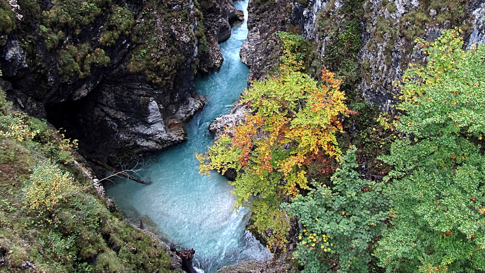
Dies ist eine kleine Wanderung vom Lautersee über die spektakuläre Leutaschklamm zur Ebertkanzel und dann weiter zum Ferchensee. Die Route ist auch für weitgehend ungeübte Wanderer angenehm zu laufen.

Further information at

http://www.leutaschklamm.com/

Tour gallery

Tour map and elevation profile

  • Open Street Map
  • Google
Minimum height 941 m Maximum height 1182 m Detailed view

More about the tour author

RonPabst
Member since 2010

Send private message

Comments

Am Lautersee und am Ferchensee gibt es Wanderbusse.

GPS tracks

Trackpoints
  • GPX / Garmin Map Source (gpx) download
  • TCX / Garmin Training Center® (tcx) download
  • CRS / Garmin Training Center® (crs) download
  • Google Earth (kml) download
  • G7ToWin (g7t) download
  • TTQV (trk) download
  • Overlay (ovl) download
  • Fugawi (txt) download
  • Kompass (DAV) Track (tk) download
  • Track data sheet (pdf) download
  • Original file of the author (gpx) download

More about the tour author

RonPabst
Member since 2010

Send private message
Share track
Add to my favorites
Remove from my favorites
Edit tags
My score
Rate
Track: Mittenwald - kleine Runde
Type: Hiking
Distance: 12,4 km
Evaluated on:
Duration:
Day(s)
Hour(s)
Minute(s)
Score: Landscape Fun factor Fitness Technique