


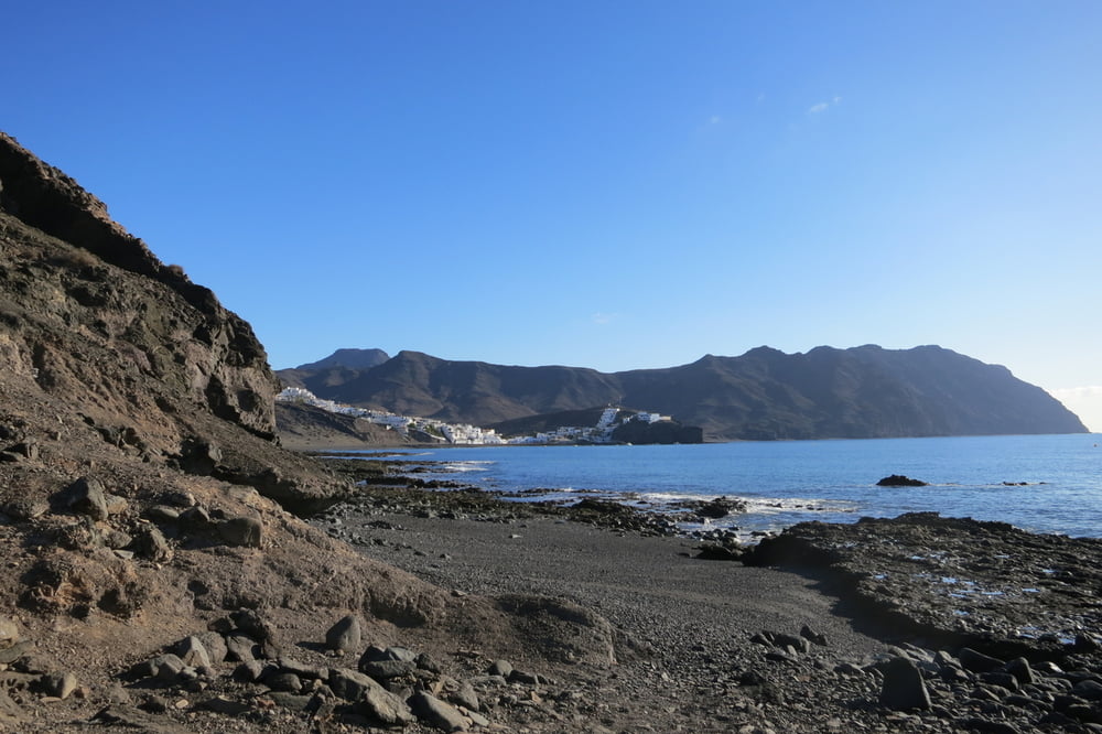
Von Playitas über die Hügel nach Gran Tarajal. Wegen losem Gestein sind die Wege (T2) teilweise etwas schwierig aber trotzdem lohnenswert (schöne Aussichten).
Wir starten am Parkplatz vom "Hotel Playitas" zum Strand. An der Strandpromenade entlang bis dessen Ende.
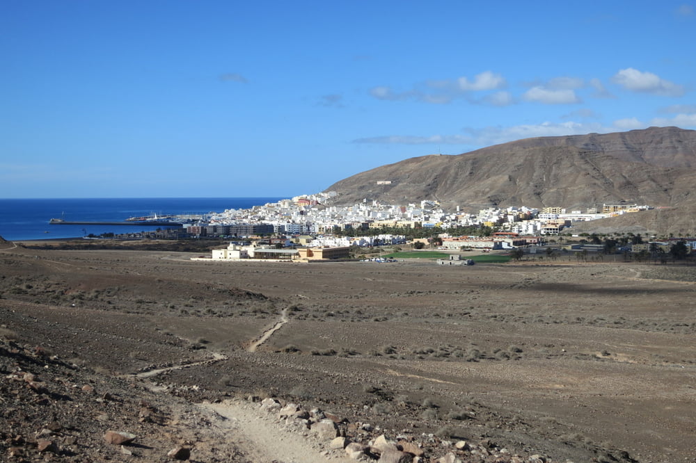
Nun geht es auf Bergpfaden (T2) über die Hügel. In Gran Tarajal angekommen, laufen wir eine kleine Runde durch den Ort.
Zurück geht es zwischen der FV-4 und dem ausgetrockneten Flussbett entlang und durchqueren diesen. Ein kurzes Stück auf dem neuen Radweg und biegen dann rechts auf einem Schotterweg ab. Nach dem ersten Haus geht es links weg. Auf einem Bergpfad über den Hügel zurück zum Ausgangspunkt.
Further information at
http://www.playitas.info/deTour gallery


Tour map and elevation profile
Minimum height 9 m
Maximum height 136 m
More about the tour author
|
|
W-C |
Comments

Anfahrt nach Playitas:
Von Puerto Del Rosario kommend auf der Fv-2, abbiegen auf die Fv-4 Richtung Gran Tarajal, dann abbiegen auf die Fv-512 Richtung Las Playitas. Am Kreisverkehr rechts zum Playitas Resort Hotel.
Parkplatz Koordinaten:
N28° 13.802'
W13° 59.327'
Von Puerto Del Rosario kommend auf der Fv-2, abbiegen auf die Fv-4 Richtung Gran Tarajal, dann abbiegen auf die Fv-512 Richtung Las Playitas. Am Kreisverkehr rechts zum Playitas Resort Hotel.
Parkplatz Koordinaten:
N28° 13.802'
W13° 59.327'
GPS tracks
Trackpoints-
GPX / Garmin Map Source (gpx) download
-
TCX / Garmin Training Center® (tcx) download
-
CRS / Garmin Training Center® (crs) download
-
Google Earth (kml) download
-
G7ToWin (g7t) download
-
TTQV (trk) download
-
Overlay (ovl) download
-
Fugawi (txt) download
-
Kompass (DAV) Track (tk) download
-
Track data sheet (pdf) download
-
Original file of the author (gpx) download
More about the tour author
|
|
W-C |
Add to my favorites
Remove from my favorites
Edit tags
Open track
My score
Rate