


1.Tag: Prien – Entenlochklamm – Westendorf, 75 km, 800 Hm
2.Tag: Westendorf – Filzenscharte – Krimmler Tauernhaus, 57 km, 1800 Hm
3.Tag: Tauernhaus – Krimmler Tauern – Bruneck – Montal, 71 km, 1200 Hm
4.Tag: Montal – Ellen – Mauraberghütte, 28 km, 1700 Hm
5.Tag: Mauraberghütte – Würzjoch – Gömajoch – Schlütterhütte – Broglesalm – St. Ulrich, 42 km, 1500 Hm
6.Tag: St. Ulrich – Seiseralm – Tierser Alp – Schlern – St. Cyprian, 38 km, 2000 Hm
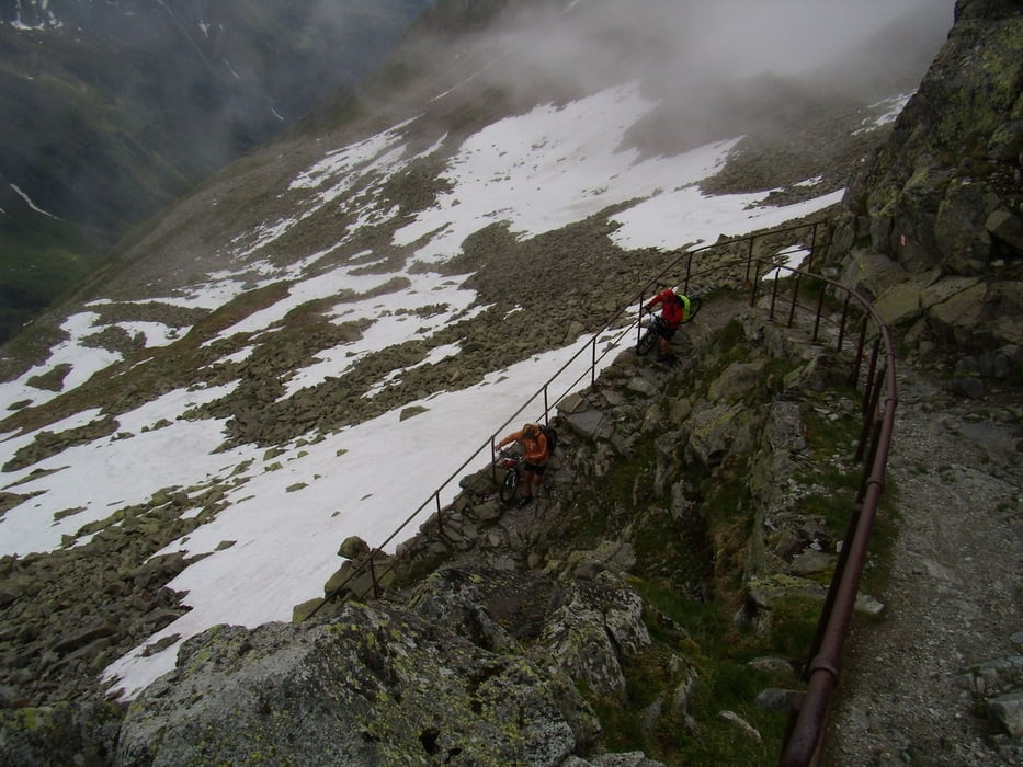
Abfahrt vom Schlern über den Prüglweg war wegen Bauarbeiten nicht möglich, mußten unsere Räder auf einen Wanderweg ins Tal schieben.
7.Tag: St. Cyprian – Nigerjoch – Karerpass – Passo Sadole – Rifugio Refavaie, 54km, 1800 Hm
8.Tag: Rifugio – Cinque Crocci – Valsugana – Trient, 81 km, 1250 Hm
Tour gallery
Tour map and elevation profile
Minimum height 208 m
Maximum height 2643 m
More about the tour author
|
|
radrige |
Comments

Mit der Bahn nach Prien am Chiemsee, von Trient mit Zug zurück
GPS tracks
Trackpoints-
GPX / Garmin Map Source (gpx) download
-
TCX / Garmin Training Center® (tcx) download
-
CRS / Garmin Training Center® (crs) download
-
Google Earth (kml) download
-
G7ToWin (g7t) download
-
TTQV (trk) download
-
Overlay (ovl) download
-
Fugawi (txt) download
-
Kompass (DAV) Track (tk) download
-
Track data sheet (pdf) download
-
Original file of the author (gpx) download
More about the tour author
|
|
radrige |
Add to my favorites
Remove from my favorites
Edit tags
Open track
My score
Rate