Login

Forgot your login?

Cookies have to be accepted!
Your browser's cookie functionality is disabled. Please enable this functionality.

Not a member yet?

Register now
Login

Available for registred users only

Log in to use this feature.

Forgot your login?

Cookies have to be accepted!
Your browser's cookie functionality is disabled. Please enable this functionality.

Not a member yet?

Register now
Filter
Categories
Advanced filters
  • Distance (km)
  • Height
Save filters Reset filter

TrackRank

QRCode

Technical data

Distance13,9 km Height1727 m Way down1758 m Duration03:00 h:m Date06.11.2014
Scores Author Landscape Fun factor Fitness Technique

Statistics

312 Views Scores 30 Downloads Average
Rate
  • Track data sheet
  • Directions
  • Downloads

Vom Parkplatz des Skigebietes bis zum höchsten Lift. Von dort dem Rücken bis zum Gipfel folgen. Abfahrt wie Anstieg. 

GPX-track beinhaltet einen zweiten Aufstieg über die obersten 400 Höhenmeter.
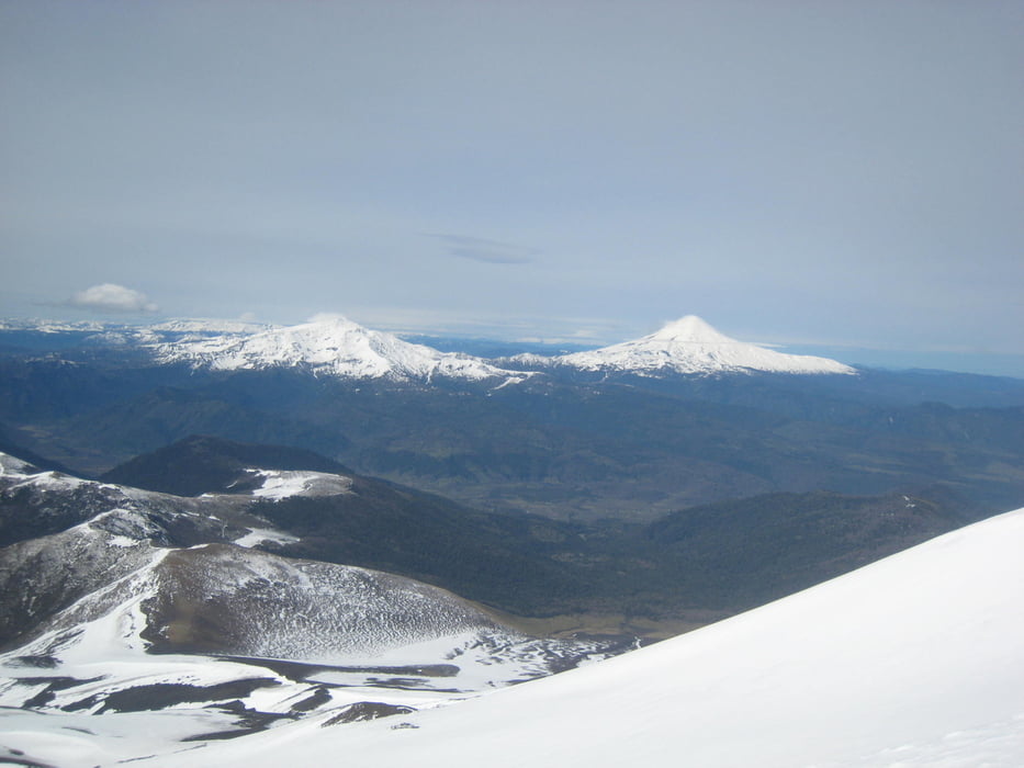
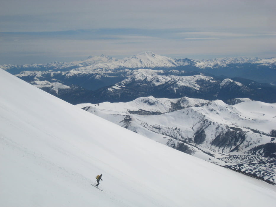
 

Tour gallery

Tour map and elevation profile

  • Open Street Map
  • Google
Minimum height 1585 m Maximum height 2867 m Detailed view

More about the tour author

Gi
Member since 2010

Send private message

Comments

Von Victoria über 181 nach Curacautin und Malalcahuello. Danach links halten und über R-89 und R-785 zum Skigebiet


GPS tracks

Trackpoints
  • GPX / Garmin Map Source (gpx) download
  • TCX / Garmin Training Center® (tcx) download
  • CRS / Garmin Training Center® (crs) download
  • Google Earth (kml) download
  • G7ToWin (g7t) download
  • TTQV (trk) download
  • Overlay (ovl) download
  • Fugawi (txt) download
  • Kompass (DAV) Track (tk) download
  • Track data sheet (pdf) download
  • Original file of the author (gpx) download

More about the tour author

Gi
Member since 2010

Send private message
Share track
Add to my favorites
Remove from my favorites
Edit tags
My score
Rate
Track: Lonquimay
Type: Ski touring
Distance: 13,9 km
Evaluated on:
Duration:
Day(s)
Hour(s)
Minute(s)
Score: Landscape Fun factor Fitness Technique