


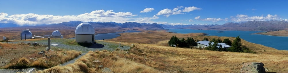
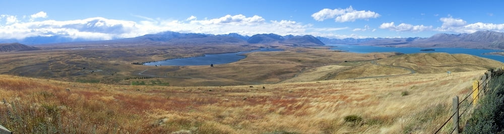
Eine kleinere BIke Tour von Lake Tekapo/Ort zum Observatorium auf dem Gipfel des Mount John. 10 km einfache Entfernung. gpx Datei im Nachhinein mit Oruxmaps erstellt.
Naja, gut, es ist jetzt keine lange, konditionell sonderlich anstrengende oder auch nur näherungsweise abenteuerliche "MTB" Tour, aber ich fand, vom Gipfel hatte man tolle Ausblicke auf die Seen und die Südalpen. Man könnte natürlich auch hochwandern (siehe #14831) oder einfach mit dem Auto hochfahren (buh!). Oben gibt's zur Belohnung ein Käffchen im Observatoriums Cafe.
Wir sind nach der Erklimmung des Mount John noch ein Stückchen die Sraße hinunter zum Lake Alexandria gefahren (nicht in den Daten enthalten). Bikes haben wir, soweit ich mich erinnere, am Lake Tekapo Motels & Holiday Park geliehen.
Interessant könnte vielleicht auch die von den Kennett Brüdern angeführte MTB Tour das Ostufer hinauf sein: http://www.kennett.co.nz/
Tour gallery
Tour map and elevation profile
Minimum height 99999 m
Maximum height -99999 m
More about the tour author
|
|
mackator |
Comments

Lake Tekapo Motels & Holiday Park
GPS tracks
Trackpoints-
GPX / Garmin Map Source (gpx) download
-
TCX / Garmin Training Center® (tcx) download
-
CRS / Garmin Training Center® (crs) download
-
Google Earth (kml) download
-
G7ToWin (g7t) download
-
TTQV (trk) download
-
Overlay (ovl) download
-
Fugawi (txt) download
-
Kompass (DAV) Track (tk) download
-
Track data sheet (pdf) download
-
Original file of the author (gpx) download
More about the tour author
|
|
mackator |
Add to my favorites
Remove from my favorites
Edit tags
Open track
My score
Rate