Login

Forgot your login?

Cookies have to be accepted!
Your browser's cookie functionality is disabled. Please enable this functionality.

Not a member yet?

Register now
Login

Available for registred users only

Log in to use this feature.

Forgot your login?

Cookies have to be accepted!
Your browser's cookie functionality is disabled. Please enable this functionality.

Not a member yet?

Register now
Filter
Categories
Advanced filters
  • Distance (km)
  • Height
Save filters Reset filter

TrackRank

QRCode

Technical data

Distance34,9 km Height777 m Way down757 m Duration02:45 h:m Date03.01.2015
Scores Author Landscape Fun factor Fitness Technique

Statistics

225 Views Scores 37 Downloads Average
Rate
  • Track data sheet
  • Directions
  • Downloads

Fantastische MTB Tour in der Kapregion - permitpflichtig


Further information at

http://tokaimtb.co.za/

Tour gallery

Tour map and elevation profile

  • Open Street Map
  • Google
Minimum height 77 m Maximum height 738 m Detailed view

More about the tour author

mikean99
Member since 2009

Send private message

Comments

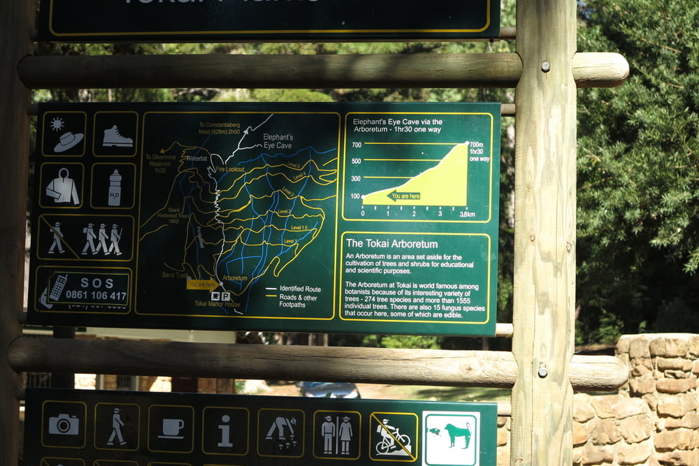
In Kapstadt in südlicher Richtung in den Vorort Constantia bis in den Ortstail Tokai. Dor tdie Tokairoad bis zm Eingang des Tokai Forrest.

GPS tracks

Trackpoints
  • GPX / Garmin Map Source (gpx) download
  • TCX / Garmin Training Center® (tcx) download
  • CRS / Garmin Training Center® (crs) download
  • Google Earth (kml) download
  • G7ToWin (g7t) download
  • TTQV (trk) download
  • Overlay (ovl) download
  • Fugawi (txt) download
  • Kompass (DAV) Track (tk) download
  • Track data sheet (pdf) download
  • Original file of the author (gpx) download

More about the tour author

mikean99
Member since 2009

Send private message
Share track
Add to my favorites
Remove from my favorites
Edit tags
My score
Rate
Track: Tokai Forrest Trails
Type: Mountain bike
Distance: 34,9 km
Evaluated on:
Duration:
Day(s)
Hour(s)
Minute(s)
Score: Landscape Fun factor Fitness Technique