
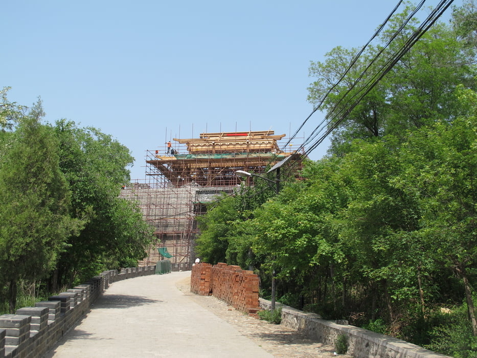

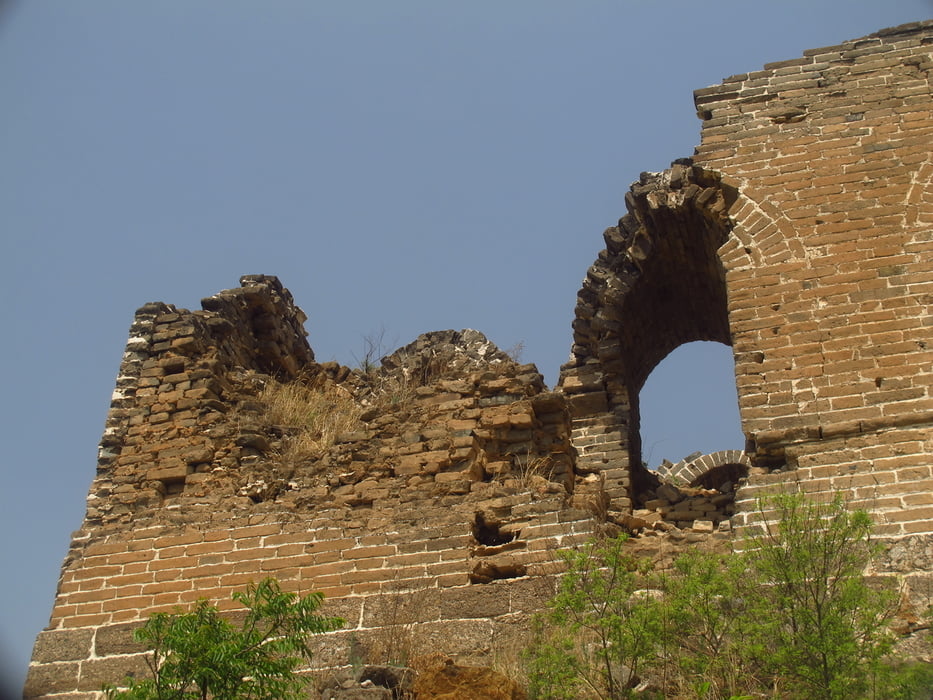
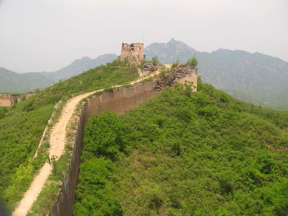
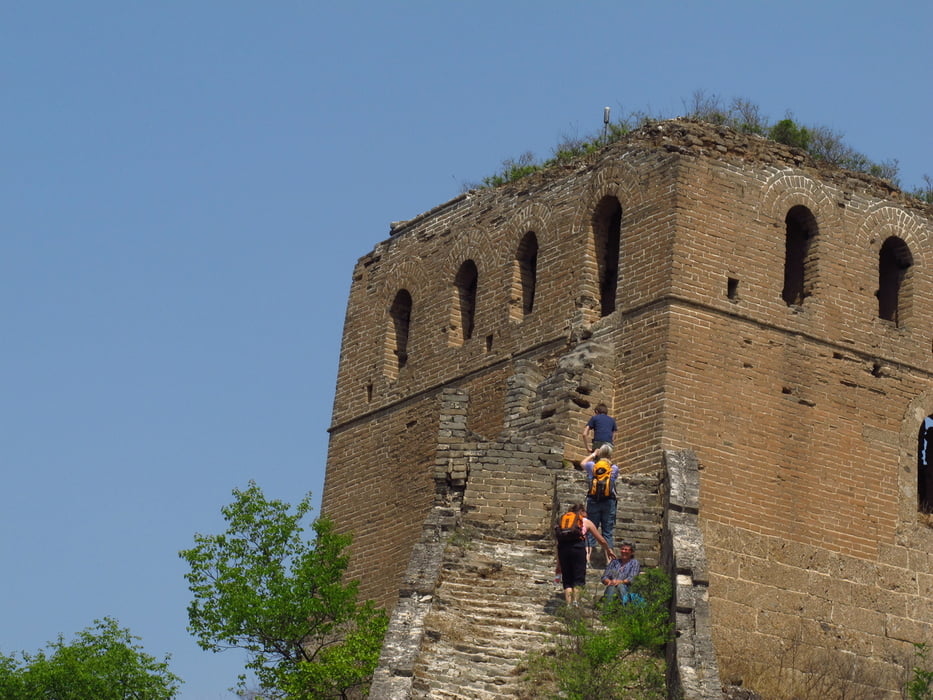
Es ist für den Nationalpark Gubeikou Eintritt zu bezahlen. Vom Parkplatz geht es Richtung neu renovierten Tor (2014). Vor dem Tor rechts hoch über einen schmalen Pfad hoch. Eine schöne Aussicht in das Tal vor dem Tor. Dem Pfad folgen bis zur Mauer. Auf und neben der Mauer in östliche Richtung weiter. Bis zum 16 Augen Turm. Ein auffälliger Turm dar nur noch aus Fassade von zwei Wänden besteht. Danach beginnt ein militärisches Sperrgebiet. Die Wanderung führt aber etwa 2,5 km zurück auf dem Weg den man gekommen ist. Nach einem Turm führt die Wanderung nach links südlich in ein Tal. Über Stufen erreicht man einen Parkplatz Die geteerte Straße führt zum Fluss und dann weiter am Fluss entlang zum Ausgangspunkt. Im Dorf gibt es einige Restaurants in denen man Essen kann.
Tour gallery

Tour map and elevation profile
Minimum height 217 m
Maximum height 478 m
More about the tour author
|
|
Hastati |
Comments

Auto mit Fahrer mieten.
GPS tracks
Trackpoints-
GPX / Garmin Map Source (gpx) download
-
TCX / Garmin Training Center® (tcx) download
-
CRS / Garmin Training Center® (crs) download
-
Google Earth (kml) download
-
G7ToWin (g7t) download
-
TTQV (trk) download
-
Overlay (ovl) download
-
Fugawi (txt) download
-
Kompass (DAV) Track (tk) download
-
Track data sheet (pdf) download
-
Original file of the author (gpx) download
More about the tour author
|
|
Hastati |
Add to my favorites
Remove from my favorites
Edit tags
Open track
My score
Rate