


24.07.2014
1.Etappentag
Sulzfeld bis Schwabmühlhausen 248 Km und einer Fahrzeit von 10:10 Stunden, 2265m Anstieg
2.Etappentag
Schwabenmühlhausen bis Neukirchen an Grossvenediger 226 Km und einer Fahrzeit von 10:20 Stunden, 2511m Anstieg
3.Etappentag
Neukirchen an Grossvenediger bis Thal-Aue 145 Km und einer Fahrzeit von 9:40 Stunden, 2652m Anstieg
http://www.urlauburlaub.at/gasthof/85969/aue-gasthof/assling
4. Etappentag
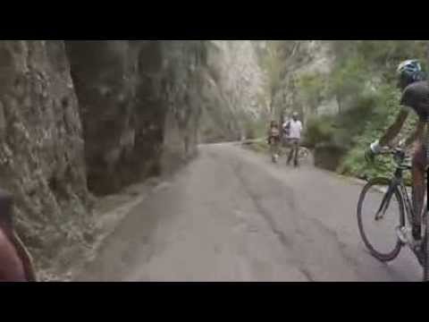
Thal-Aue bis zur Serrai-Schlucht von Sottoguda 107 Km und einer Fahrzeit von 6:40 Stunden, 2134m Anstieg
http://www.albergogenzianella.it/
5.Etappentag
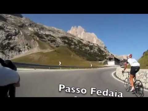
Serrai-Schlucht von Sottoguda bis Romallo 139Km und einer Fahrzeit von 9:50 Stunden, 3071m Anstieg
6.Etappentag
Romallo bis Santa Caterina 89Km und einer Fahrzeit von 6:50 Stunden, 3112m Anstieg
http://www.hotelpedranzini.it/de/
7.Etappentag
Santa Caterina bis Tirano 56Km und einer Fahrzeit von 6:50 Stunden, 410m Anstieg
http://www.hotelberninatirano.com/
8.Etappentag
Rückreise mit dem Zug, die Wetterbedinungen machten uns einen Strich durch unsere Planungen.
Further information at
http://www.rsv-sulzfeld.deTour gallery

Tour map and elevation profile
Minimum height 165 m
Maximum height 2618 m
More about the tour author
|
|
Stefan68 |
Comments
Mit dem Rennrad,
zurück mit den Zug, durch die Schweiz,
GPS tracks
Trackpoints-
GPX / Garmin Map Source (gpx) download
-
TCX / Garmin Training Center® (tcx) download
-
CRS / Garmin Training Center® (crs) download
-
Google Earth (kml) download
-
G7ToWin (g7t) download
-
TTQV (trk) download
-
Overlay (ovl) download
-
Fugawi (txt) download
-
Kompass (DAV) Track (tk) download
-
Track data sheet (pdf) download
-
Original file of the author (gpx) download
More about the tour author
|
|
Stefan68 |
Add to my favorites
Remove from my favorites
Edit tags
Open track
My score
Rate
Sottoguda-Schlucht unpassierbar