


Altdorfer Rundwanderweg 5a+5: Altdorf-Rasch-Schwarzachtal-Lenzenberg-Altdorf
> Länge: 7,5 km
> Höhenmeter: 80m
> Gehzeit: 1h 45min
> Charakteristik:
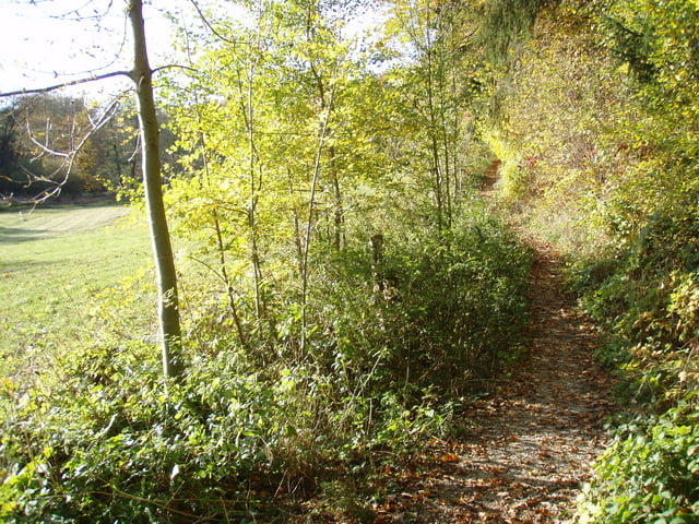
kurze, aussichtsreiche Tour ins Schwarzachtal
> MTB: Fußgänger haben Vorrang!
bei Sonne und typischer Spaziergangzeit bitte meiden
> MTB Charakteristik:
schöner Singletrail abwärts(Fußgänger!)(rot) und Schotterweg am Fluss entlang (blau) ; aufwärts Treppen (schieben) und steiler Asphaltanstieg (schwarz)
in Umkehrrichtung: Treppen bergab (gelb) und Singletrail bergauf (schwarz)
> MTB Schwierigkeitsgrade:
blau(leicht), rot(mittel), schwarz(schwierig), gelb(extrem schwierig)
http://www.tirol.gv.at/themen/sport/radfahren/mountainbike/modell/schwierigkeitsgrade
> MTB Fahrzeit: 30min
> MTB Weg: 1,5km Trail, 1,5km Schotter, 4,5km Asphalt
> MTB Kontakt: http://www.dav-altdorf.de/mtb, Email: Bergrad@dav-altdorf.de
> Einkehrmöglichkeit: Gaststätten in Rasch
> Wegverlauf:
Bahnhof (Markierung 5)
Kappelgraben
Stadthalle
Unteres Tor
Rascher Straße
Grasiger Weg
Autobahnunterführung
links in Feldweg zum Spielplatz einbiegen
rechts Pfad Richtung Wald und abwärts bis Rasch
auf Teerstraße scharf rechts abbiegen auf Schotterweg (Markierung 5a)
an Abwasseranlage vorbei
rechts aufwärts nach Lenzenberg (Treppen)
Straße geradeaus bergauf bis Autobahnunterführung (Markierung 5)
Grasiger Weg
Rascher Straße
Unteres Tor
Stadthalle
Kappelgraben
Bahnhof
Further information at
http://dav-altdorf.de/Rundwanderwege/Rundwanderwege.htmTour gallery


Tour map and elevation profile
Minimum height 370 m
Maximum height 455 m
More about the tour author

|
Comments

90518 Altdorf b. Nürnberg, Marktplatzbrunnen (Unterer Markt 1)
Anfahrt über
> BAB A3 AS90 Altdorf-Burgthann
http://maps.google.de/maps?f=d&hl=de&geocode=8478614486286564428,49.408521,11.343622&saddr=49.381926,11.340122&daddr=90518+altdorf,+unterer+Markt+1&mra=pe&mrcr=0&sll=49.395279,11.35334&sspn=0.040835,0.11467&ie=UTF8&ll=49.389385,11.347289&spn=0.04084,0.11467&t=h&z=14
>BAB A6 AS62 Altdorf-Leinburg
http://maps.google.de/maps?f=d&hl=de&geocode=8478614486286564428,49.408521,11.343622&saddr=St2240+%4049.408521,+11.343622&daddr=90518+altdorf,+unterer+Markt+1&mra=pe&mrcr=0&sll=49.38664,11.357819&sspn=0.002553,0.007167&ie=UTF8&ll=49.395279,11.35334&spn=0.040835,0.11467&t=h&z=14
>VGN S-Bahn S2 von Nürnberg
http://vgn.de
GPS tracks
Trackpoints-
GPX / Garmin Map Source (gpx) download
-
TCX / Garmin Training Center® (tcx) download
-
CRS / Garmin Training Center® (crs) download
-
Google Earth (kml) download
-
G7ToWin (g7t) download
-
TTQV (trk) download
-
Overlay (ovl) download
-
Fugawi (txt) download
-
Kompass (DAV) Track (tk) download
-
Track data sheet (pdf) download
-
Original file of the author (gpx) download
More about the tour author
|
|
Add to my favorites
Remove from my favorites
Edit tags
Open track
My score
Rate