Login

Forgotten password?

Cookies have to be accepted!
Your browser's cookie functionality is disabled. Please enable this functionality.

Not a member yet?

Register now
Login

Available for registred users only

Log in to use this feature.

Forgotten password?

Cookies have to be accepted!
Your browser's cookie functionality is disabled. Please enable this functionality.

Not a member yet?

Register now
Filter
Categories
Advanced filters
  • Distance (km)
  • Height
Save filters Reset filter

TrackRank

QRCode

Technical data

Distance22,6 km Height532 m Way down477 m Duration02:45 h:m Date26.03.2008
Scores Author Landscape Fun factor Fitness Technique

Statistics

465 Views Scores 111 Downloads Average
Rate
  • Track data sheet
  • Directions
  • Downloads
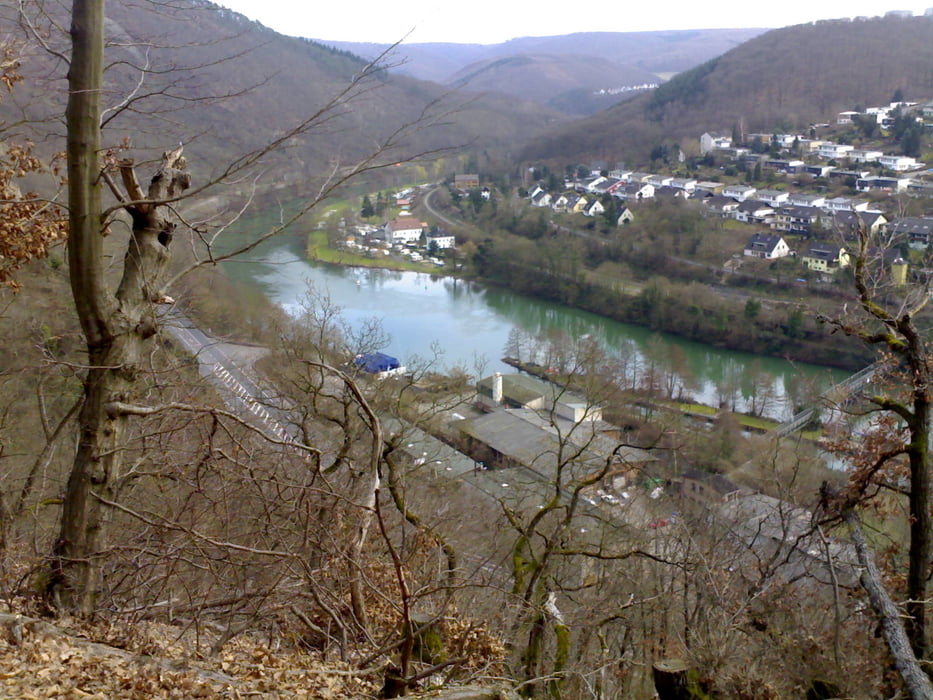
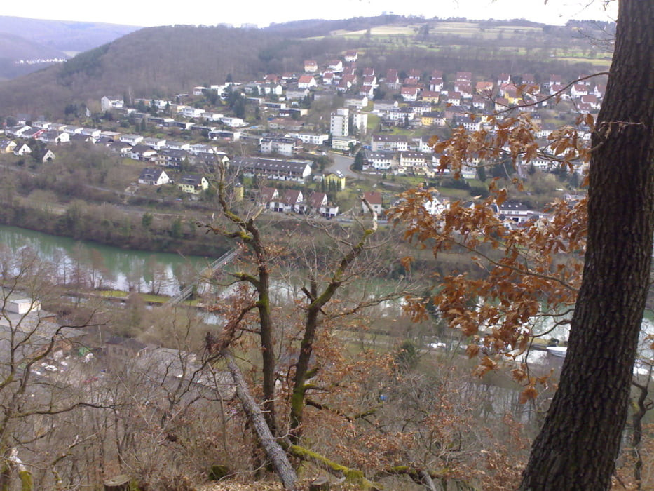
Feierabendtour mit herrlichen Aussichten auf Lahn und gegenüberliegende Anhöhen. Meist geschotterte Waldwege. Lediglich der kapitale Anstieg links der Ruprechtsklamm erfordert technisch hohes Schiebe-Können ;-)

Tour gallery

Tour map and elevation profile

  • Open Street Map
  • Google
Minimum height 63 m Maximum height 304 m Detailed view

More about the tour author

berufsradler
Member since 2007

Send private message

Comments

GPS tracks

Trackpoints
  • GPX / Garmin Map Source (gpx) download
  • TCX / Garmin Training Center® (tcx) download
  • CRS / Garmin Training Center® (crs) download
  • Google Earth (kml) download
  • G7ToWin (g7t) download
  • TTQV (trk) download
  • Overlay (ovl) download
  • Fugawi (txt) download
  • Kompass (DAV) Track (tk) download
  • Track data sheet (pdf) download
  • Original file of the author (gpx) download

More about the tour author

berufsradler
Member since 2007

Send private message
Share track
Add to my favorites
Remove from my favorites
Edit tags
My score
Rate
Track: Oberau - Lahnhöhen
Type: Mountain bike
Distance: 22,6 km
Evaluated on:
Duration:
Day(s)
Hour(s)
Minute(s)
Score: Landscape Fun factor Fitness Technique