


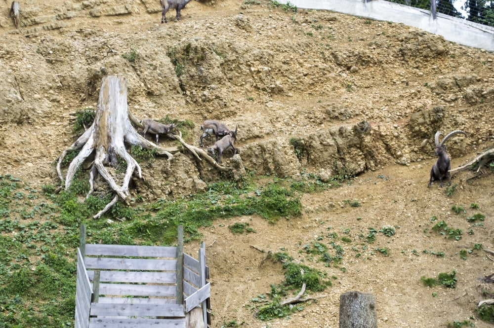
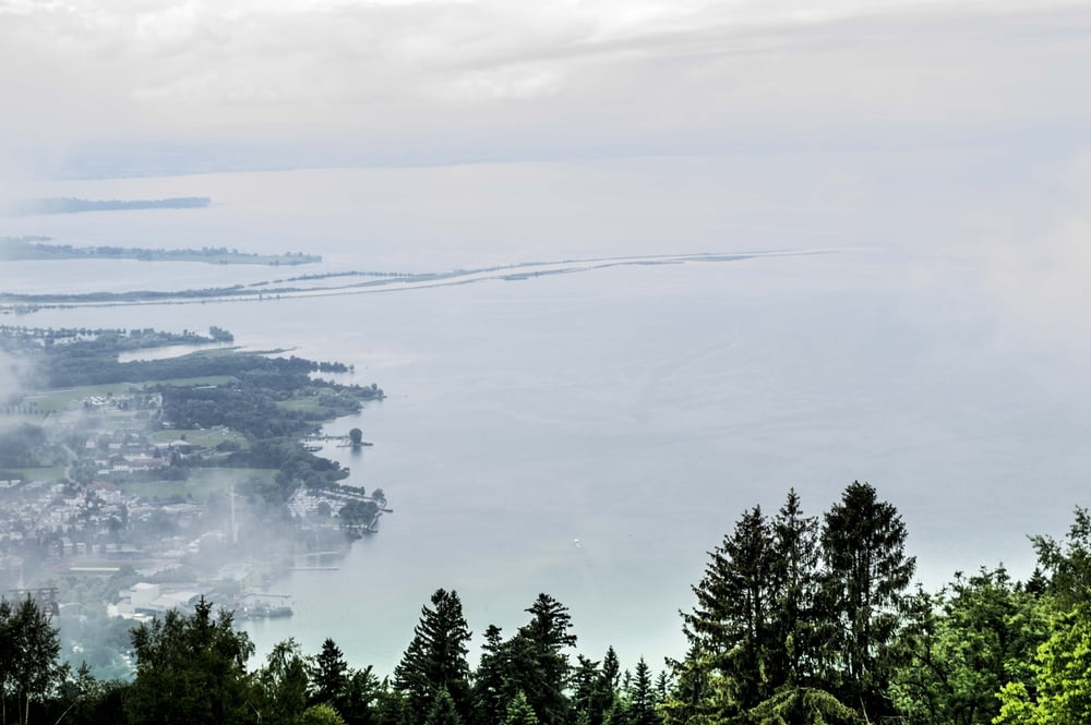
Die Tagestour von Scheidegg durch das deutsch-österreichische Voralpenland zum 1064 m hohen Pfänder ist familienfreundlich und mit dem Kinderwagen zum Teil sehr gut zu meistern. Bis zum Pfänder sind es ca. 12 km Fußmarsch.Der Pfänder bietet einen herrlichen Blick auf die Alpen und den ganzen Bodenseeraum(Wetterbedingt). Wer nicht auf die selbe strcke zurück laufen will, kann mit der Gondel nach Bregenz hinunterfahren. und mit Bus nach Scheidegg zurückfahren.
Tour gallery


Tour map and elevation profile
Minimum height 825 m
Maximum height 1049 m
More about the tour author
|
|
ajdda |
Comments

Start und Ziel Scheidegg Wanderparkplatz Am Hammerweiher Am Strassen Rand.
GPS tracks
Trackpoints-
GPX / Garmin Map Source (gpx) download
-
TCX / Garmin Training Center® (tcx) download
-
CRS / Garmin Training Center® (crs) download
-
Google Earth (kml) download
-
G7ToWin (g7t) download
-
TTQV (trk) download
-
Overlay (ovl) download
-
Fugawi (txt) download
-
Kompass (DAV) Track (tk) download
-
Track data sheet (pdf) download
-
Original file of the author (gpx) download
More about the tour author
|
|
ajdda |
Add to my favorites
Remove from my favorites
Edit tags
Open track
My score
Rate